
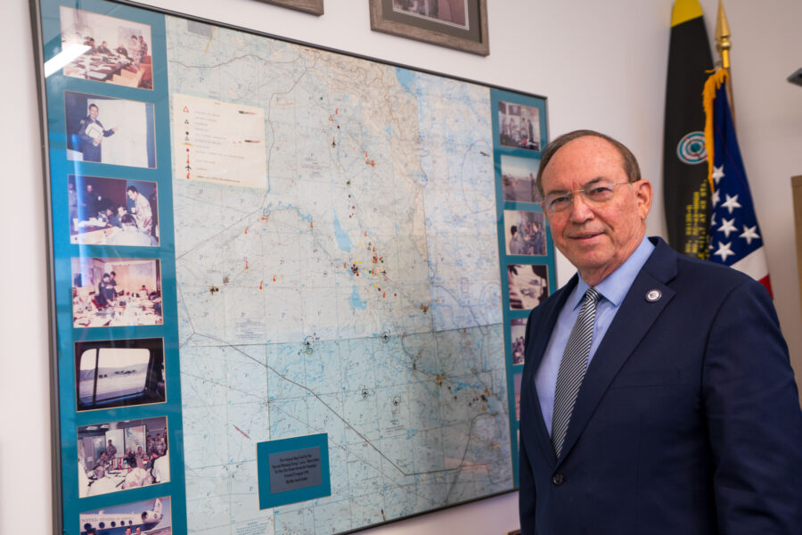
A map pinned to the wall in a basement 36 years ago will go on display in November at the Smithsonian’s National Air and Space Museum.
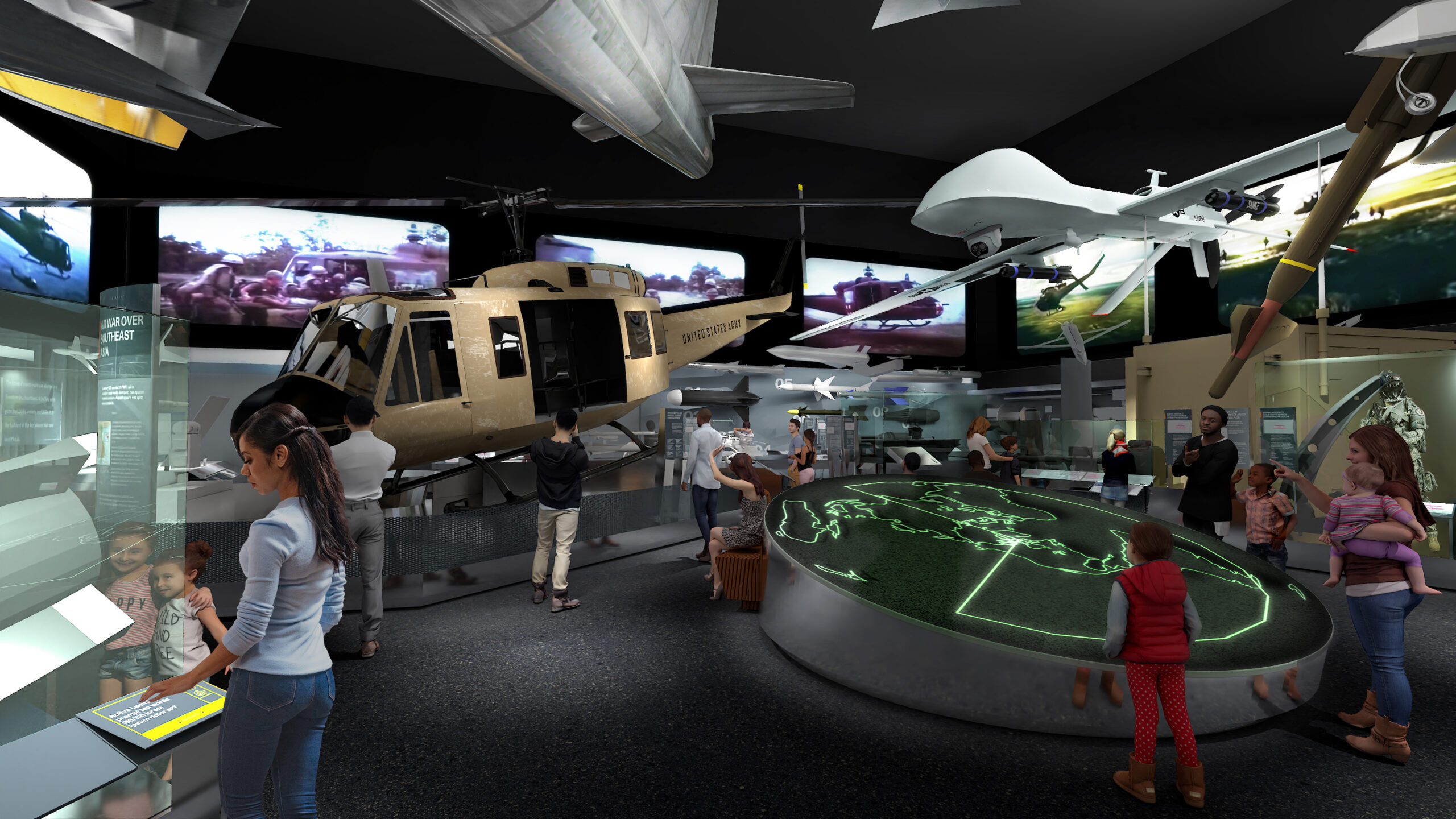
The map, used to identify strategic targets across Iraq in the fall of 1990, was used in the planning of Operation Desert Storm, and will be included in the museum’s new “Modern Military Aviation” gallery in Washington D.C., tracing advances in airpower from the Korean War to the present.
The exhibit seeks to expose visitors to the advances that changed the nature of warfare.
The map is one of two created at the time by now-retired Lt. Gen. David Deptula, Dean of the Mitchell Institute for Aerospace Studies. Deptula was the principal air attack planner for Operation Desert Storm—identifying strategic targets across Iraq and developing the blueprint for the coalition air campaign.
Two Gulf War maps remain in Deptula’s possession, and both are on display at AFA’s headquarters in Arlington: one depicting Baghdad hangs in AFA’s Heritage Hall, while a larger map of Iraq hangs in Deptula’s office, surrounded by other mementos and artifacts from throughout his career.
A reproduction of the map will be displayed as a large-format graphic panel at the Smithsonian. Dr. Michael Hankins, the Smithsonian’s Curator of U.S. Air Force, Navy, and Marine Corps post-World War II Aviation, learned about the maps during a chance conversation with the Mitchell Institute’s Executive Director Doug Birkey. Hankins was aware the maps had existed, but did not know they had been carried back from Saudi Arabia after the war.
Hankins immediately recognized the narrative the maps could tell and saw them as a perfect bridge for the exhibit he was creating, one that could help tell the story of the evolution from conventional airpower to the age of stealth and precision bombing that has defined military strike operations ever since.
Given the map’s fragility and size, Hankins decided a reproduction would be more accessible to visitors at the Smithsonian.
“As we were planning the layouts for some of these different labels, we had an opportunity, particularly in that section, to have a large-scale photo as an introduction to the Desert Storm section of the gallery,” Hankins said. “What better visual image to use than this to speak to that? … [It shows] how the thought process of using military aviation was different in 1991 than it might have been in previous conflicts.”
The Map, Deptula, and the Black Hole
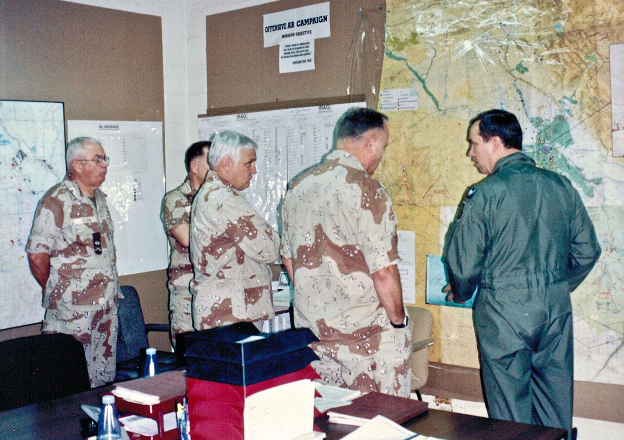
While the map tells the story of Operation Desert Storm, it is also a pivotal artifact in the career of the officer who led the planning of that operation over countless 20-hour days in a basement room in Riyadh, Saudi Arabia, that came to be known as “the Black Hole.” On Aug. 2, 1990, Iraqi forces under dictator Saddam Hussein invaded neighboring Kuwait and conquered the country within days. In response, a coalition led by the United States was formed to eject Saddam’s forces from Kuwait.
Deptula, then a lieutenant colonel working in the Office of the Secretary of the Air Force, was pulled into a Pentagon strategic planning cell known as “Checkmate,” led by Col. John Warden III. The Checkmate team had been developing a new strategic air doctrine for the post-Cold War era when it was tasked to create an operational concept for countering Iraq’s invasion with airpower. They dubbed their plan “Instant Thunder.” After briefing Army Gen. Norman Schwarzkopf, who as commander of U.S. Central Command would oversee the operation, as well as Gen. Colin Powell, then the Chairman of the Joint Chiefs, Warden, Deptula and a couple of others flew to Saudi Arabia to brief Gen. Chuck Horner, the top air commander for the theater, on the plan.
Horner, unconvinced of Warden’s ability to lead the actual planning, accepted Warden’s concept, but sent Warden back to Washington, while retaining the others. Among them, only Deptula stayed long term, becoming the principal target planner for the entire campaign.
Based in the Royal Saudi Air Force headquarters basement, their “Black Hole” office was defined by secrecy, the sensitive political nature of American forces planning offensive operations on Saudi soil, and the punishing hours demanded of its occupants—and, Deptula recalled, once “someone was allowed to come into it, they were never allowed to go out.”
Here Deptula created his map and the Master Air Attack Plan that would ultimately orchestrate every strike of the campaign. On the map, Deptula and his team pinpointed strategic targets, coded by category: air defense, leadership, military bases, Scud ballistic missile launchers, command and control systems, and electricity and telecommunications networks.
The map helped planners to identify relationships between targets, coordinate force packages across multiple objectives simultaneously, and find gaps in Iraqi defenses that a list of coordinates alone could not reveal. For example, the map revealed a gap in Iraqi border monitoring stations that allowed Deptula to safely route F-15E attack aircraft to strike Scud launchers in western Iraq before they could fire on Israel. “It wasn’t just a pretty map that hung on the wall in our planning cell,” Deptula said. “That’s what the visualization of a map does that a bunch of target coordinates and names doesn’t.”
Underlying the Instant Thunder concept was the conviction that airpower could systematically dismantle Iraq’s war-making ability. Each mark aimed to take a specific capability off the table. It was a deliberate break from what Deptula called “an attritional, intelligence-based philosophy” that had defined air campaigns in Vietnam, where success was measured by the percentage of damage inflicted rather than by what capability had actually been removed.
Using the F-117 Nighthawk’s stealth capability to lead the attack, and precision munitions to ensure rapid success, coalition air forces disabled Iraq’s command and control almost instantly, and took away other war-making capabilities within weeks—all while greatly minimizing overall infrastructure damage across the country.
By targeting electrical transformer yards, rather than power plants, planners saw they could shut down the electrical grid while keeping reconstruction manageable. In some cases, Deptula recalled, Iraqi power plant managers switched off their facilities, and the coalition chose not to strike them.
“By the third night of the war, there hadn’t been an electron flowing in the Iraqi power grid,” said Deptula. “So that’s the objective.” For Hankins, the map illustrated the evolution of airpower in a way no other artifact could. He said, “I think the map shows that in an interesting way, because you can see who’s targeting what, what kinds of things they are able to target, what kinds of things they were successful at. It’s different than something you would see in the sections on the Korean War or the Vietnam War.”
Serving as the visual introduction, the map opens the gallery’s Desert Storm section, which focuses on the new technologies that defined the conflict: a scale model of an F-117 stealth fighter and an interactive display explaining how stealth technology works and why it proved so decisive.
Separately, the museum’s Steven F. Udvar-Hazy Center near Dulles Airport received an original F-117 in October, so Washington visitors can see the real thing up close.
The Desert Storm section will also serve as a bridge to the conflicts of the Global War on Terror that the United States has fought over the past three decades, including the Predator drone Deptula would later help pioneer as an armed platform. After the September 11 attacks, Deptula was directing the Combined Air Operations Center for the opening of the Afghanistan campaign when the United States fired a Hellfire missile from an RQ-1 Predator at al-Qaeda targets, the first combat use of an armed remotely piloted aircraft.
For Deptula, the map’s display at the Smithsonian represents an acknowledgment of a turning point in how America wages war and as validation of the campaign itself. “I think it’s recognition of the significance of the operation,” Deptula said. “It was the birth of how we conceive air operations.”
For Hankins, the map’s greatest value may be what it teaches visitors who know nothing about the Gulf War. “It’s not just let’s launch a bunch of airplanes and go drop a bunch of weapons,” he said. “It’s much more careful than that. It takes a lot of people a lot of time.”
The Modern Military Aviation gallery, the final chapter of the Smithsonian’s eight-year renovation, is scheduled to open to the public on Veterans Day, Nov. 11, 2026.