

Audio of this article is brought to you by the Air & Space Forces Association, honoring and supporting our Airmen, Guardians, and their families. Find out more at afa.org

Space Domain Awareness
Ground-based and space-based sensors for tracking objects in every orbital regime
Space Domain Awareness · Phased Array Radar
AN/FPS-85 (Eglin Phased Array Radar)
Space Domain Awareness
The AN/FPS-85 is a very large-fixed array radar located at Eglin AFB. Initially designed to track satellites, a software update installed in 1975 enabled the unit to track submarine-launched ballistic missiles, or SLBMs. This became the 20th Space Surveillance Squadron’s primary mission, while space surveillance became secondary. From 1971 to 1984 the 20th Surveillance Squadron served as the Alternate Space Surveillance Center, providing computational support to the Space Surveillance Center at Cheyenne Mountain AS, Colo. If the need arose, the squadron could assume command and control of worldwide SSN. During the 1980s, the AN/FPS-85 was the proving ground for development of phased array radars designed specifically for early warning of SLBM attacks. The AN/FPS-85 can detect, track, and identify up to 200 satellites simultaneously and provides 120-degree azimuth of coverage. Generating a combined output of 32 megawatts, the radar can track an object the size of a basketball at a range of more than 35,000 km. The AN/FPS-85 was the first radar purpose-built for the mission.
Space Domain Awareness · S-Band Radar
AN/FSY-3 (Space Fence)
Space Domain Awareness
The AN/FSY-3 (Space Fence) S-band radar is the dedicated southern hemisphere space surveillance asset, capable of low-inclination tracking. The second-generation space surveillance system is designed to track and detect any object larger than a softball in low-Earth orbit, as well as some deep space objects. It replaced the VHF Air Force Space Surveillance Systems (AFSSS), also called Space Fence, which ceased operations in 2013. Operated by the 20th Space Surveillance Squadron, it can detect, track and identify up to 500 satellites simultaneously. The unique structural design allows for 360-degrees of azimuth coverage. The antenna covers +20° to +90° elevation. The radar can track an object the size of a beach ball at a range of more than 36,000 km. In May, Lockheed Martin was awarded a $27 million modification contract by Space Systems Command for radar optimization, software maintenance, and intelligence support functions as well as additional upgrades.
Space Domain Awareness · Electro-Optical
GEODSS (Ground-Based Electro-Optical Deep Space Surveillance) Sites
Space Domain Awareness
Since the early 1980s, the Ground-Based Electro-Optical Deep Space Surveillance (GEODSS) System has played a central role in tracking deep space objects. It is a nine passive sensor array of visible wavelength reflecting telescopes. These are globally distributed across the following three sites (with three telescopes per site): White Sands Missile Test Range, Socorro, N.M. (Det. 1, 15th Space Surveillance Squadron); Diego Garcia, British Indian Ocean Territories (Det. 2, 15th Space Surveillance Squadron); Mount Haleakala, Maui Island, Hawaii (Det. 3, 15th Space Surveillance Squadron). These telescopes play a central role in tracking deep space objects and are each able to “see” objects 10,000 times dimmer than the human eye. Over the years, the GEODSS systems have undergone several refurbishments and upgrades, the most significant being the addition of digital cameras. These highly sensitive digital camera technologies—developed under a program known as Deep STARE—can detect multiple satellites in the telescope’s field of view. The telescopes take rapid electronic snapshots of satellites in the night sky, showing up on the operator’s console as tiny streaks. Star images, which remain fixed, are used as reference or calibration points for each of the three telescopes. The resulting observation data is then sent instantaneously to Delta 2 for the management of the satellite catalog data. On April 7, L3Harris won a $150 million contract modification as part of MOSSAIC—Maintenance of Space Situational Awareness Integrated Capabilities—a program to provide reliable, accurate, and timely surveillance to military, civil, and commercial stakeholders to protect space assets and ensure freedom of movement in space.
Space Domain Awareness · Optical
Maui Space Surveillance System (MSSS)
Space Domain Awareness
The Maui Space Surveillance Complex (MSSC) is national space surveillance and research asset. Located at the 10,023-foot summit of Haleakala on the island of Maui, Hawaii, the MSSC hosts small-, medium-, and large-aperture tracking optics, including the DOD’s largest optical telescope designed for tracking and imaging satellites, with visible and infrared sensors to collect data on near-Earth and deep-space objects. The MSSS is operated by the 15th Space Surveillance Squadron. The AEOS 3.6 m and other smaller contributing telescope systems validate and develop advanced technology for transition to the dedicated sensor baseline while also executing a contributing SDA mission on behalf of the USSF. These contributing sensors support experiments and leverage R&D capabilities by AFRL. DOD began conducting research and development and operational missions on Mount Haleakala in the early 1960s at the Advanced Research Projects Agency Midcourse Observation Station, which is known today as the Maui Space Surveillance Complex. Originally built as an electro-optical observation platform for missile tests, the site has evolved into a world-class observatory supporting missions in space control, laser propagation, and other related fields. Testing of the modernized telescope, the Ground Based Optical Sensor System (GBOSS) began in October 2025. It has double the view of the previous variant, more rapid scanning, and is three times more sensitive to light. This falls under the L3Harris’ MOSSAIC upgrade program. This will bring increased visibility into orbit for the Maui Space Surveillance System.
Space Domain Awareness · Classified SSA
Silent Barker
Space Domain Awareness
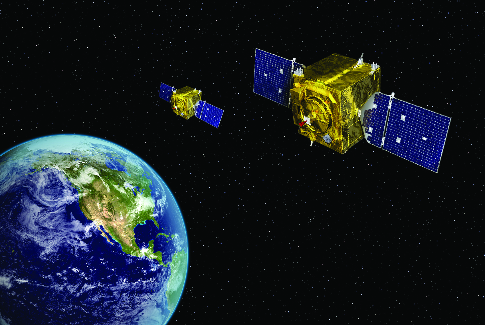
Silent Barker is a classified space-based Space Situational Awareness (SSA) system jointly developed by the U.S. Space Force (USSF) and the National Reconnaissance Office (NRO). It was launched in September 2023. The system consists of three satellites designated USA 346, USA 347, and USA 348, which were placed into orbit above geosynchronous Earth orbit (GEO) at a 12-degree inclination. After approximately a year of on-orbit testing, the first series of Silent Barker satellites became operational in early 2025. The system is expected to reach full operational capacity following a planned launch in FY26. Silent Barker’s mission differs from the Geosynchronous Space Situational Awareness Program (GSSAP). Silent Barker is focused on wide-area surveillance while GSSAP is responsible for doing characterization to detect anomalies or provide intricate characterization of satellites in geosynchronous orbit. Data collected by Silent Barker is transmitted to classified military users including the USSF’s National Space Defense Center and the Combined Space Operations Center, while the NRO operates the satellites. In May, the Space Force increased the value of its recently awarded Andromeda ID/IQ contract from $1.8 billion to more than $6.2 billion to buy the future replacement surveillance spacecraft (SG-XX) for Silent Barker.
- USA 346 — Launched September 2023; active
- USA 347 — Launched September 2023; active
- USA 348 — Launched September 2023; active
Orbital Surveillance · Object Identification
Space-Based Space Surveillance (SBSS)
Orbital Surveillance and Object Identification
SBSS is designed to track, characterize, measure, and collect optical signatures of Earth-orbiting objects, including space vehicles and debris. Built by Boeing, SBSS primarily uses a trainable, ground-controlled Space-Based Visible Sensor to track satellites and was meant to cover a four-year gap in coverage until the Space Force can launch a follow-on spacecraft. SBSS works in concert with an array of networked, ground-based sensors including the Space Fence wide-area search and surveillance system on Kwajalein Atoll in the Marshall Islands. SBSS collision-warning data were made openly available to the public in 2020 to improve domain awareness and orbital safety, and USSF is considering handing off operations to a contracted service provider.
- SBSS Block 10 — Launched in 2010; active
Orbital Warfare
Space-based assets for geosynchronous orbit surveillance, tracking, and characterization
Situational Awareness · Orbital Tracking
Geosynchronous Space Situational Awareness Program (GSSAP)
Situational Awareness/Orbital Tracking
GSSAP supplies space-based tracking and characterization of man-made objects in geosynchronous orbit, aiding safety, and enabling avoidance. They are the “neighborhood watch” satellites. The satellites operate in near-geosynchronous orbit to effectively monitor objects and aid in preventing collisions in space. GSSAP carry EO/IR sensors and are able to maneuver to observe objects at close range or conduct rendezvous. They can track objects beyond the weather and atmospheric disruptions that affect ground-based systems. Two GSSAP satellites were launched in 2014 and attained IOC in 2015. Two more replenishment satellites launched Aug. 19, 2016, and became operational Sept. 12, 2017. USSF completed a significant overhaul and upgrade of the GSSAP ground system software to enhance the reliability, speed, and security of the system in February 2020. The upgrades also pave the way for future expansion of the constellation. The fifth and sixth sensors launched aboard the USSF-8 mission from Cape Canaveral on Jan. 21, 2022, and were declared operational several months later. USSF announced the on-orbit decommissioning of GSSAP 2 on Aug. 2, 2023. On Feb. 12, 2026, the Space Force launched GSSAP 7 & 8 satellites aboard ULA Vulcan Centaur to enhance space domain awareness. Two more are in production, and the service is pursuing a commercial follow-on/supplemental program called RG-XX.
- GSSAP 1 — Launched in 2014; on orbit, active
- GSSAP 2 — Launched in 2014, nonoperational orbit, decommissioned in 2023
- GSSAP 3 — Launched in 2016, on orbit, active
- GSSAP 4 — Launched in 2016, on orbit, active
- GSSAP 5 — Launched in 2022, on orbit, active
- GSSAP 6 — Launched in 2022, on orbit, active
- GSSAP 7 & 8 — Launched in 2026, on orbit, active

Satellite Communications
U.S. Space Force Satellite Constellations — Active & Legacy Systems
Communications · EHF
Advanced Extremely High Frequency (AEHF) Satellite System
Communications
AEHF provides global, secure, protected, and jam-resistant military communications. It enhances the previous Milstar satellites and operates at a much higher capacity and data rate. It offers secure, anti-jam tactical and strategic communications around the world. AEHF uses cross-linked satellites, eliminating the need for ground relay stations. The program is a collaboration with Australia, Canada, the Netherlands, and the United Kingdom. SV-4 launched on Oct. 17, 2018; full operational capability was declared when the vehicle joined the constellation on May 3, 2019. SV-5 launched Aug. 8, 2019, and SV-6 launched from Cape Canaveral on March 26, 2020, marking the newly formed USSF’s first launch. SV-6 became operational after completing on-orbit checks on Aug. 22, 2020, completing the constellation. USSF plans to begin replacing AEHF with the next-generation Evolved Strategic SATCOM (ESS) for nuclear C2 starting in the early 2030s, while developing Protected Tactical SATCOM (PTS) to relive AEHF of providing contested battlefield comms. Space Systems Command awarded Boeing a $2.8 billion contract to build and deliver the first two satellites in the ESS (Evolved Strategic SATCOM) program, replacing the current NC3 capability on AEHF. USSF is developing the Protected Tactical Enterprise Service (PTES) to enable global anti-jam, low probability of intercept comms. PTES waveforms will initially be fielded on WGS, later expanding commercial satellites and eventually to PTS. USSF plans to complete prototype PTS payloads in FY25 for hosted launch on WGS-11 as well as a second stand-alone satellite.
- AEHF SV-1 — Launched in 2010, on orbit and operational
- AEHF SV-2 — Launched in 2012, on orbit and operational
- AEHF SV-3 — Launched in 2013, on orbit and operational
- AEHF SV-4 — Launched in 2018, on orbit and operational
- AEHF SV-5 — Launched in 2019, on orbit and operational
- AEHF SV-6 — Launched in 2020, on orbit and operational
Communications · GEO Relay
Continuous Broadcast Augmenting SATCOM (CBAS)
Satellite Communications
The Continuous Broadcast Augmenting SATCOM is a set of geostationary satellites designed to provide communications relay capabilities to support senior leaders and combatant commanders. The CBAS system includes two satellites in geostationary orbit designed to broadcast military data continuously through space-based satellite communications relay links. The satellites enhance existing military satellite communications capabilities by providing additional relay capacity for time-sensitive information. The system supports the communication needs of senior leadership and combat commanders with secure, reliable data transmission. The first CBAS satellite (CBAS-1) was successfully launched on April 14, 2018, from Cape Canaveral as the primary payload on the AFSPC-11 mission aboard an Atlas V rocket directly into geostationary orbit. CBAS-2 was subsequently launched on Jan. 15, 2023, on a Falcon Heavy rocket as part of the USSF-67 mission. A third satellite (CBAS-3) is planned for future deployment to further enhance the constellation’s capabilities. The system transitioned from U.S. Air Force to U.S. Space Force operations following the creation of the Space Force in December 2019. CBAS is managed by Space Systems Command, formerly the Military Satellite Communication Director of USAF’s Space and Missile Defense Center.
- CBAS 1 — Launched in 2018; active
- CBAS 2 — Launched in 2023; active
Satellite Communications · SHF/UHF
Defense Satellite Communications System III (DSCS III)
Satellite Communications
The Defense Satellite Communications System III (DSCS III) is the third generation of the U.S. military’s premier geostationary communications constellation, succeeding the earlier DSCS II satellites. Beginning in 2007, it began to be phased out in favor of the Wideband Global SATCOM (WGS). Initially comprised of 14 satellites launched between October 1982 and August 2003, the constellation now consists of four satellites. These final four satellites received Service Life Enhancement Program (SLEP) modifications that provide substantial capacity improvements through higher-power amplifiers, more sensitive receivers, and additional antenna connectivity options. The DSCS communications payload includes six independent Super High Frequency (SHF) transponder channels that cover a 500 MHz bandwidth. The DSCS III satellites carry six independent Super High Frequency (SHF) transponders and one special purpose single channel transponder operating on both SHF and Ultra High Frequency (UHF). The satellites feature three receive antennas (two Earth coverage horns, one steerable 61-beam nulling lens) and five transmit antennas (two Earth coverage horns, two steerable 19-beam wave guide lenses, one high gain parabolic gimbaled dish). Two solar wings produce 1700 Watts of onboard power at the beginning of life and 1230 watts at the end of life. The U.S. Army’s CECOM Software Engineering Center plans to transfer full life cycle sustainment responsibilities for the Wideband SATCOM Operational Management System (WSOMS)—WGS and DSCS payloads—to the U.S. Space Force in FY26, after previously handing over satellite ground stations in 2021.
- DSCS-3 B13 (#10) (USA 134) — Launched October 25, 1997; Active
- DSCS-3 B8 (#11) (USA 148) — Launched January 21, 2000; Active
- DSCS-3 A3 (#13) (USA 167) — Launched March 11, 2003; Active
- DSCS-3 B6 (#14) (USA 170) — Launched August 29, 2003; Active
Satellite Communications · UHF/EHF
FLTSATCOM (Block 2)
Satellite Communications
Fleet Satellite Communications System (FLTSATCOM) currently consists of two operational satellites used by the Air Force, Navy, and presidential command network. The system is designed to provide secure communications links among the three users. Each FLTSATCOM satellite includes 22 communications channels in the ultra-high and super-high frequency bands that support nuclear command and control. FLTSATCOM Block 2 (consisting of FLTSATCOM 6-8) is an upgrade from the FLTSATCOM Block 1 design and includes an Extremely High Frequency (EHF) communications package that served as a test bed for Milstar system terminals. Both 7 & 8 were transferred to the USSF in 2021 following the stand up of the Space Force. As of September 2025, one FLTSATCOM remains active, but it is nonoperational for use in secure communications. UFO/MUOS has taken over its duties.
- FLSATCOM 7 — Launched in 1987; active
- FLSATCOM 8 — Launched in 1989; active
Communications · EHF Strategic
Milstar Satellite Communications System (MILSTAR)
Communications
Milstar is the legacy joint-service backbone of strategic/tactical DOD communications. It provides encrypted, secure, anti-jam communications around the world and uses cross-linked satellites, eliminating the need for ground relay stations. Block I satellites incorporate a low-data-rate payload capable of transmitting 75 to 2,400 bps over 192 EHF channels. Block II satellites carry both the low-data-rate payload and a medium-data-rate payload capable of transmitting 4,800 bps to 1.5 Mbps over 32 channels, allowing larger data to be passed more quickly. Interoperable terminals allow third-party land/sea-based units to upload data in real time to cruise missiles or other compatible weapons. Milstar provides continuous coverage between 65 degrees north and 65 degrees south latitude. The systems utilize multiple-redundant command and control for high survivability. The last of six satellites launched in 2003 and was augmented by the sixth and final AEHF satellite in 2020. AEHF now supplants Milstar as DOD’s primary system in the combined, fully back-compatible AEHF-Milstar constellation. Milstar surpassed 30 years of operations Feb. 7, 2024, exceeding its on-orbit design life by three times.
- Block I — Milstar I satellites launched 1994-95
- Block II — Milstar II satellites launched 1999-2003
Communications · UHF Narrowband
Mobile User Objective System (MUOS)
Communications
MUOS provides next-generation global UHF narrowband and BLOS military SATCOMS. The constellation was originally developed by Lockheed Martin for the Navy and is designed to replace the legacy UHF Follow-On (UFO) system, enabling a tenfold increase in capacity as well as interoperability with legacy terminals. Each satellite is equipped with an advanced SATCOM payload that converts 3G cellular-like service to military UHF as well as a UHF payload compatible with UFO terminals. MUOS provides tactical air, land, and sea platforms reliable SATCOMS even in challenging terrain and weather conditions and also extends SATCOMS to the high Arctic. The system utilizes both geosynchronous satellites and ground-station relays to provide mobile phone-type, voice, text, and data to users in the field. MUOS can interface with the Defense Switched Network and DOD’s Global Information Grid offering clear voice and videoconferencing over existing networks. The system comprises four operational satellites, an on-orbit spare, and four ground relay stations in addition to networking and satellite control. USSF aims to procure two additional MUOS satellites targeted for launch by 2030, coinciding with the projected end life of the initial vehicles. Service life extension efforts initiated by the Navy would procure two additional satellites, equipped only with the advanced Wideband Code Division Multiple Access (WCDMA) payload to replace the oldest satellites in orbit by 2030. Full exploitation of MUOS’ capabilities has been hampered by the slow modernization of user platforms to date, and many USAF platforms are in the process of transition. The Naval Satellite Operations Center transferred its remaining UHF satellites, including five legacy UHF Follow-Ons, a single remaining UHF FLTSAT, and two range-extending nanosats to the USSF along with control of MUOS on June 6, 2022. General Dynamics got a $28.4 million contract for sustainment and modernization of the ground segment of the Mobile User Objective system. It is expected to be complete by 2027. Canada reached IOC becoming the first allied MUOS user in June 2024, with full operational capability for Canadian Forces achieved in 2026.
- MUOS-1 — Launched in 2012, on orbit and operational (CONUS/Americas)
- MUOS-2 — Launched in 2013, on orbit and operational (Pacific)
- MUOS-3 — Launched in 2015, on orbit and operational (Atlantic)
- MUOS-4 — Launched in 2015, on orbit and operational (Indo-Asia)
- MUOS-5 — Launched in 2016, on-orbit spare
Satellite Communications · UHF
Ultra-High Frequency Follow-On (UFO)
Satellite Communications
The UHF Follow On (UFO) satellite series provides critical ultra-high frequency communications for the U.S. Navy’s global network, serving ships at sea and various military terminals. These satellites replaced the Fleet Satellite Communications (FLTSATCOM) and Hughes-built Leasat spacecraft, establishing a more capable and flexible communications infrastructure. While a total of 11 were launched, beginning in 1993, only four remain operational today. The UFO satellites utilize a modular payload architecture operating in geosynchronous orbit. Earlier satellites (UFO-4 through UFO-7) were built by Hughes and incorporated an EHF payload alongside UHF and SHF capabilities, providing protected communications with anti-jam features. Block 3 satellites (UHF-8 to -10) replaced the SHF payload with the Global Broadcast Service (GBS) package and included four 130-watt, 24 Mbps military Ka-band (30/20 GHz) transponders with three steerable downlink spot beam antennas and dedicated uplink antennas. This technical configuration delivered a 96 Mbps data transmission capability per satellite—a significant increase over previous generations. Block 4 of the UFO was designed by Boeing and consists of a single satellite (UFO-11) launched on Dec. 18, 2003. It was intended to serve as a gap filler between the UFO and MUOS constellations. UFO-11 satellite incorporates the enhanced 20-channel EHF package first introduced on UFO-7, while adding an upgraded UHF payload with a new digital receiver that provides two additional UHF channels and greater flexibility in configuring communication services. UFO-11 maintains the same physical dimensions as earlier non-GBS Block 2 satellites. The UFO has been fully replaced by the Mobile User Objective System (MUOS). Although it is still in orbit, it is no longer being modernized. The FY26 budget included $49 million for MUOS upgrades, and USSF projects around $50 million in upgrades per year over the next five years.
- UFO 8 (Block 3) — Launched in 1998; active
- UFO 9 (Block 3) — Launched in 1998; active
- UFO 10 (Block 3) — Launched in 1998; active
- UFO 11 (Block 4) — Launched in 2003; active
Communications · Ka/X-Band Wideband
Wideband Global SATCOM (WGS) Satellite
Communications
WGS provides worldwide, high-capacity communications for deployed air, land, and sea forces. The system is designed to augment and then replace DSCS X-band frequency service. It also augments the one-way Global Broadcast Service Joint Program Ka-band frequency capabilities and provides a new high-capacity, two-way Ka-band frequency service. Block I includes: SV-1 (Pacific region), SV-2 (Middle East), and SV-3 (Europe and Africa). Block II satellites are modified to better support the airborne ISR mission and include: SV-4 (Indian Ocean), and SV-5 and SV-6, purchased by Australia in 2013. The U.S. is partnering with Canada, Denmark, Luxembourg, the Netherlands, and New Zealand on Block II follow-on satellites SV-7 to SV-10. The Space and Missile Systems Center conducted tests to field anti-jamming capability for SV-1 through SV-10 starting in 2022. Congress added funds to procure the 11th and 12th satellites, but USSF opted for the single, modernized WGS-11+ platform. Congress added FY23 funds to again procure WGS-12 to ensure depth of coverage, augmenting the future Protected Tactical SATCOM (PTS), which will provide battlefield coverage in contested spectrum environments. USSF demonstrated PTS and is working to field an IOC capability using a WGS satellite for the Indo-Asia Pacific theater. The Boeing-designed WGS-11+ will offer roughly twice the capability, in addition to stronger, more reliable coverage and was initially slated for launch in 2025, but is now scheduled for later this year. It will host a dedicated PTS payload in addition to being the first WGS satellite carried into orbit by a ULA Vulcan Centaur. Poland and Japan signed agreements to join WGS in 2024 primarily utilizing the two latest satellites.
- SV-1. Block I — Launched in 2007; active
- SV-2. Block I — Launched in 2009; active
- SV-3. Block I — Launched in 2009; active
- SV-4. Block II — Launched in 2009; active
- SV-5. Block II — Launched in 2013; active
- SV-6. Block II — Launched in 2013; active
- SV-7. Block II follow-on — Launched in 2015; active
- SV-8. Block II follow-on — Launched in 2016; active
- SV-9. Block II follow-on — Launched in 2017; active
- SV-10. Block II follow-on — Launched in 2019; active

Missile Warning / Tracking
Space-based and ground-based systems providing strategic and tactical ballistic missile early warning
Missile Warning/Tracking · Space-Based IR
Space-Based Infrared System (SBIRS)
Space-based Surveillance/Missile Warning
SBIRS provides advanced space surveillance and missile warning, battlespace characterization, and technical intelligence gathering. It is the follow-on to the Defense Support Program satellite. The system includes IR sensor payloads on host satellites in highly elliptical orbit (HEO), two IR sensors each on dedicated satellites in geosynchronous Earth orbit (GEO), and ground assets. The HEO sensor detects launch of submarine-launched ballistic missiles (SLBMs) from the North Pole region and can be tasked for other IR detection missions. GEO scanning IR sensor performs the strategic missile warning mission, global technical intelligence, and initial phase for the strategic missile defense mission, providing two times the revisit rate and three times the sensitivity of DSP. GEO-5 and -6 are based on a modernized spacecraft that will begin migration to the next-generation Enterprise Ground Service (EGS), consolidating control of multiple systems. USSF also awarded Raytheon a contract in 2020 to modernize ground data processing. The Future Operationally Resilient Ground Evolution (FORGE) system will serve both SBIRS and the future Next-Generation Overhead Persistent Infrared (OPIR) system. Next-Gen OPIR was originally meant to include three satellites in GEO built by Lockheed Martin and two polar HEO sensors from Northrop Grumman, but the Space Force announced plans in its 2027 budget request to cancel the polar portion of the program. The first Next-Gen OPIR GEO satellite, originally planned for launch in FY25, is facing delays due to payload issues and is now slated for launch in FY26. The first HEO sensors are scheduled for delivery in FY28. The final SBIRS GEO satellite (GEO-6) successfully blasted off from Cape Canaveral in 2022 and was operationally accepted March 24, 2023. GEO-5 and GEO-6 will replace the oldest satellites on orbit. SBIRS and DSP provided warning to U.S. and Israeli forces of Iranian strikes in April and October 2024, enabling defense against the largest missile attacks in history. GEO-6 was the final SBIRS satellite launch.
- SBIRS HEO-1 — Payload operational in 2008; on-orbit reserve
- SBIRS HEO-2 — Payload operational in 2009; on-orbit reserve
- SBIRS HEO-3 — Payload operational in 2015; active
- SBIRS HEO-4 — Payload operational in 2017; active
- SBIRS GEO-1 — Launched in 2011; active
- SBIRS GEO-2 — Launched in 2013; active
- SBIRS GEO-3 — Launched in 2017; active
- SBIRS GEO-4 — Launched in 2018; active
- SBIRS GEO-5 — Launched in 2021; active
- SBIRS GEO-6 — Launched in 2022; active
Strategic and Tactical Launch Detection
Defense Support Program (DSP)
Strategic and Tactical Launch Detection
DSP provides ballistic missile early warning and is a key part of North American and theater early warning systems. It is capable of detecting missile launches and nuclear detonations and was initially meant to watch the Soviet military. It was used extensively in the 1991 Gulf War to detect Iraqi theater missile launches against coalition forces and allies in the region. The 23rd and final DSP satellite launched in December 2007 but malfunctioned and began drifting outside its intended orbit in 2008. Block 5 is the latest variant and is more survivable than predecessors. It includes a medium wavelength IR sensor for more mission utility and accommodates 6,000 detectors. The constellation hosts X-ray, optical, and radiation sensors that form a key part of the Radiation Detection Capability (RADEC) supporting the U.S. Nuclear Detonation Detection System (USNDS). USNDS is capable of near-real-time atmospheric and near-space detection and location of nuclear blasts supporting tactical warning, nuclear forces, space control, treaty monitoring, and classified missions. Nine Block 5 satellites were deployed between 1989 and 2007. SBIRS is integrated with DSP, augments its role, and is designed to eventually replace the constellation on orbit. The constellations jointly enabled early detection of ballistic missiles launched by Iran against U.S. forces at Al Asad AB, Iraq, on Jan. 7, 2020, reducing casualties. When Iran launched two waves of drones and missiles against Israel in April and October 2024, systems like DSP and SBIRS gave critical warnings to U.S. forces.
- DSP-18 — Launched in 1997, on orbit and operational
- DSP-19 — Launched in 1999, on orbit and operational
- DSP-20 — Launched in 2000, on orbit and operational
- DSP-21 — Launched in 2001, on orbit and operational
- DSP-22 — Launched in 2004, on orbit and operational
- DSP-23 — Launched in 2007, on orbit and nonoperational
Missile Warning/Tracking · LEO Constellation
Proliferated Warfighter Space Architecture (PWSA)
Missile Warning/Tracking
The Proliferated Warfighter Space Architecture (PWSA) is intended to be a proliferated satellite constellation in low-Earth orbit, with new tranches projected to launch every two years, upgrading the architecture’s technological baseline on a regular basis. Tranche 0 is the “demonstration” tranche, to demonstrate the feasibility of the system’s cost, schedule, and scalability for beyond line of sight targeting and advanced missile detection and tracking. Tranche 0 includes a total of 27 optically connected space vehicles divided into two main components: Transport Layer (19) and Tracking Layer (8). The Transport Layer serves as the data backbone, connecting various satellites to each other and to warfighters, while the Tracking Layer provides missile warning and tracking capabilities. The Transport Layer consists of two configurations: Group A mesh nodes equipped with two optical communications terminals each and radio frequency receive/transmit capability, and Group B vehicles that also include a tactical data link receive/transmit capability able to connect to Link-16 transmitters. The Tracking Layer includes 8 SVs equipped with wide field of view sensor payloads and two OCTs each. Together, these satellites demonstrate low-latency data connectivity, beyond line of sight targeting, missile warning/tracking, hypersonic glide vehicle detection, and alternate position, navigation & timing (PNT) capabilities. Tranche 1 is the initial warfighting capability tranche, delivering regional coverage. It includes a total of 154 operational space vehicles divided between Transport Layer (126) and Tracking Layer (28). The first two Tranche 1 launches, in September and October 2025, included 42 Transport Layer satellites. But as of March 2026, those satellites have not finished on-orbit checkout and functional testing processes and subsequent launches have been delayed.
- 19 Tranche 0 Transport Layer satellites — active
- 8 Tranche 0 Tracking Layer satellites — active
- 42 Tranche 1 Transport Layer satellites — active
Missile Warning/Tracking · Ground Radar
Upgraded Early Warning Radar (UEWR)
Missile Warning/Tracking
The Upgraded Early Warning Radar (UEWR) system provides advanced ballistic missile detection, tracking, and space surveillance capabilities for the United States Space Force. The UEWR network consists of powerful phased-array radar systems strategically positioned in the United States and abroad. These radars are capable of detecting and tracking intercontinental ballistic missiles (ICBMs), sea-launched ballistic missiles (SLBMs), and conducting space domain awareness operations, including satellite tracking. The system operates 24/7 to provide critical early warning of potential missile threats and contribute to space surveillance networks. UEWR represents a significant modernization and upgrade of the previous generation Ballistic Missile Early Warning System (BMEWS) and PAVE PAWS radars with enhanced detection capabilities and improved integration with missile defense systems. The radar systems utilize advanced phased-array technology that allows for rapid electronic beam steering without the need for mechanical movement of the antenna. This enables simultaneous tracking of multiple targets while maintaining broad surveillance coverage across a 240- to 360-degree field of view. Operating in the Ultra High Band Frequency, these radars boast wide area coverage but are not able to perform midcourse discrimination. Under the Ground Based Radar Digitization project, or GBRD, the Space Force plans to install new hardware and software on the aging UEWR, upgrading everything from front-end antennas to back-end data processors, a transformational move from analog to digital operations.
Missile Warning/Tracking · S-Band Radar
Long Range Discrimination Radar (LRDR)
Missile Warning/Tracking
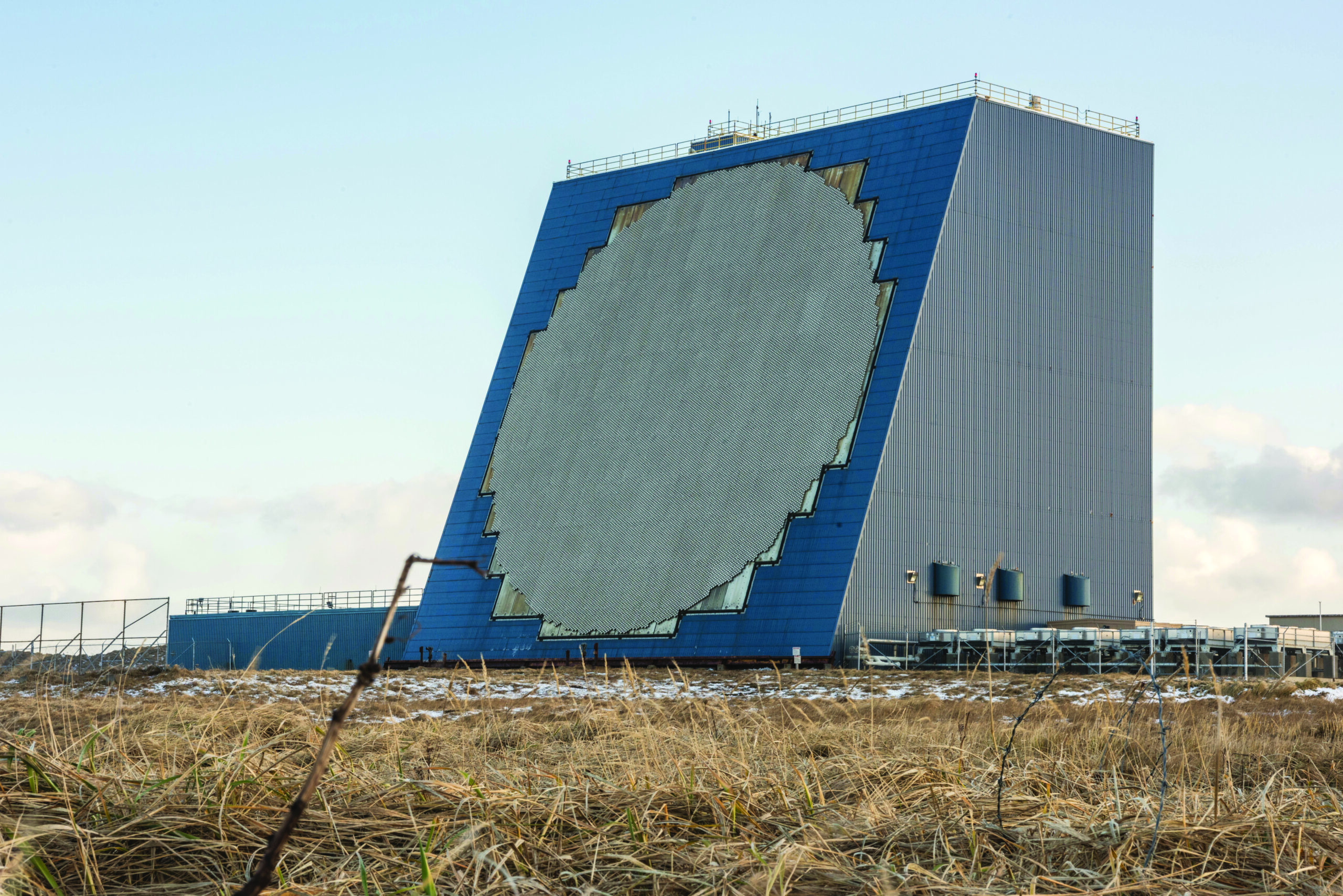
The Long Range Discrimination Radar (LRDR) is an advanced S-band radar system designed to distinguish between enemy intercontinental ballistic missiles (ICBMs) and decoys, serving as a crucial component in the defense of the American homeland. The system is based at Clear Space Force Station in Alaska and will be operated by the U.S. Space Force. Full operational acceptance of LRDR by Space Force Combat Forces Command occurred in December 2025. The LRDR serves as a critical piece of a layered defense system for the United States. It supports the ballistic missile interceptors belonging to the Ground-Based Midcourse Defense system, which are primarily designed to counter missile threats from nations such as Iran and North Korea. In addition to its primary mission of missile defense, the LRDR will also track objects in space, providing space domain awareness capabilities. The S-band radar system is specifically designed to distinguish between enemy ICBMs and decoys. Built by Lockheed Martin, the LRDR was initially fielded at Clear Space Force Station near central Alaska in late 2021. However, the system has some delays in its operational timeline. A critical assessment test, Flight Test Other-26 (FTX-26), was rescheduled to 2025 after a “target anomaly” canceled the previous year’s planned test. The test took place in June 2025, with the radar successfully detecting, tracking, and discriminating a live ballistic missile threat in a complex environment. LRDR will likely be a key element in the architecture of the Golden Dome missile defense shield.
Missile Warning/Tracking · L-Band Radar
Cobra Dane
Missile Warning/Tracking
The Cobra Dane Radar Upgrade serves as an advanced L-band radar installation at Eareckson Air Station on Shemya Island, Alaska. Originally engineered to monitor Soviet missile tests, the system underwent significant enhancements in 2004 to incorporate missile defense capabilities. Cobra Dane’s primary function involves gathering radar metric and signature data from foreign ballistic missile activities during their flight paths, as well as monitoring space launches to support treaty verification, force modernization, and missile defense initiatives. The system also conducts space surveillance, tracking both cataloged and uncatalogued satellites in low-Earth orbit to enhance Space Domain Awareness operations. The system’s impressive detection range extends to 2,000 miles, delivering missile tracking and classification data with sufficient precision to authorize interceptor launches from the Ground Midcourse Defense system and provide target updates during interceptor flight. With its phased-array technology, Cobra Dane can simultaneously track multiple objects and automatically switches to Missile Defense mode when detecting threatening missiles or receiving alert notifications. During standard operations, it focuses on space surveillance activities. Initially developed for intelligence collection supporting SALT II arms limitation treaty verification, Cobra Dane transitioned from the Missile Defense Agency to Air Force control in February 2009. By 2015, operational oversight shifted to the Air Force Life Cycle Management Center Battle Management Directorate, with Raytheon securing a maintenance contract in 2016. Currently, the 13th Space Warning Squadron provides operational support for the radar’s missile defense and space domain awareness missions. Cobra Dane’s radar system is due to be upgraded from analog to digital under the Ground Based Radar Digitization (GBRD) project, with a preliminary design review in 2027 and rapid fielding starting in 2030.
Missile Warning/Tracking · UHF Phased Array
Perimeter Acquisition Radar Attack Characterization (PARCS)
Missile Warning/Tracking
PARCS is a sophisticated UHF-phased-array radar system designed for missile defense and space surveillance, operated by the 10th Space Warning Squadron at Cavalier Space Force Station in North Dakota. The system serves as a critical early warning installation, monitoring for potential sea-launched and ICBM ballistic missile threats while providing crucial surveillance data to military command centers. Its capabilities enable comprehensive threat assessment and timely information sharing with defense authorities. The PARCS installation employs advanced radar technology to track a significant portion of Earth-orbiting objects, with its specialized array oriented toward Hudson Bay to maximize coverage of potential threat vectors. Beyond missile defense, PARCS contributes valuable data about space activities as part of the broader space surveillance network. The system processes tens of thousands of tracking operations daily, detecting everything from large satellites to space debris. PARCS originated as a component of the Army’s Safeguard missile defense program, but found continued utility in Air Force operations after the original system was decommissioned, transitioning to focus on missile warning and space surveillance. The Space Force maintains PARCS through contracted support services, with a substantial investment in its continued operation and maintenance. PARCS is due to be upgraded from analog to digital under the Ground Based Radar Digitization (GBRD) project, announced in May 2026, with a preliminary design review in 2027 and rapid fielding starting in 2030.

Positioning, Navigation & Timing
Space-based positioning, navigation, and timing for military and civil users worldwide
Worldwide Navigation, Timing, and Velocity Data
Navstar Global Positioning System (GPS)
Worldwide Navigation, Timing, and Velocity Data
GPS supplies space-based military and civil radio-positioning for geolocation, navigation, and timing. It is a fundamental enabler of precision bombing, CSAR, mapping, and rendezvous. It provides accurate and uninterrupted 3D (latitude, longitude, and altitude) position, velocity, and time data. The last of the GPS Block IIA satellites, launched between 1990 and 1997 was decommissioned in 2020. GPS Block IIR and IIR-M (modernized) included 21 vehicles launched between 2005 and 2009. Modernization upgrades included two new signals, enhanced encryption, anti-jamming capabilities, a second civil signal, and electromagnetic pulse sensors that form part of the U.S. Nuclear Detonation Detection System (NDS). GPS Block IIF is a follow-on to IIR-M. Upgrades include extended design life, faster processors, and improved anti-jam technology and accuracy, a new military signal, and a second and third dedicated civil signal. The GPS Block IIIA, first launched on Dec. 23, 2018, has improved accuracy, availability, and integrity, and incorporates a steerable, high-power, anti-jam capability. Lockheed Martin completed Block IIIA production at SV-10 in 2022. The company was awarded a follow-on contract for Block IIIF SV-11 and SV-12 as well as up to 22 additional vehicles in 2018. USSF executed options for SV-13 and SV-14 in October 2020, SV-15 to SV-17 in November 2021, and SV-18 through SV-20 in November 2022. Block IIIF will add a hosted search and rescue payload, and a geographically targetable high-power military signal. USSF worked for years on the oft-delayed Next-Generation Operational Control Segment (OCX) to enable advanced GPS III features. The launch and on-orbit check segment of OCX went operational in 2017. But concurrent Blocks 1 and 2, to enable use of modernized civil, aviation, military signals, and advanced cyber defenses, were not functioning as intended, and in April 2026, the Space Force canceled OCX and awarded Lockheed Martin a contract to develop upgrades for its interim Architecture Evolution Plan software. USSF launched GPS III SV-9 on Jan. 28, 2026, and SV-10 on April 21, 2026. The first of the IIIF satellites is slated for launch as early as 2028.
- GPS Block IIR — Launched 1997 to 2004; six active
- GPS Block IIR-M — Launched 2005 to 2009; seven active
- GPS Block IIF — Launched 2010 to 2016; 12 active
- GPS Block IIIA/IIIF — New generation launched in 2018; 10 active
Satellite Command & Control
Ground network providing command, control, tracking, and telemetry for U.S. military satellites
Satellite Control · Global Network
Satellite Control Network (SCN)
Satellite Control
The Satellite Control Network provides satellite command and control capabilities for U.S. military and other government satellites. The system includes a network of 19 globally distributed parabolic antennas spread across seven locations around the world. The SCN supports tracking, telemetry, and commanding functions, ensuring that satellites remain in the proper orbit and are performing as designed. These functions are accomplished through the network of ground stations, ground antennas, and communication links between the control centers, antennas, and satellites, strategically located around the world. The SCN is currently operating at high utilization rates while facing increasing demand. To address this, the Space Force is pursuing a range of modernization and augmentation efforts. In 2022, the Space RCO awarded BlueHalo a $1.4 billion contract for a program called the Satellite Communications Augmentation Resource, which was meant to augment as many as 12 SCN parabolic satellite dishes with electronic phased array antennas that would be able to talk to up to 20 satellites at a time rather than one. In March 2026, however, the Space Force opted to cancel the contract and instead launch a new competition that leverages commercial systems rather than one with a bespoke, military design. Delivery of all 12 dishes is expected between late 2026-2030. In July 2024, the Space Force awarded Akima’s subsidiary Five Rivers Analytics a $480 million 10-year contract to support the Satellite Control Network and help integrate new technologies into the system as they emerge. The Space Force is also exploring working with other federal agencies through Federal Augmentation Services (FAS) program to upgrade and utilize existing civil ground system infrastructure to support the SCN. The Satellite Control Network is operated by Space Delta 6’s 21st, 22nd, and 23rd Space Operations Squadrons (SOPS). The 22nd SOPS functions as the primary interface with SCN users, including scheduling satellite contacts. The 21st and 23rd SOPS execute operations and maintenance of SCN antenna systems and tracking stations in the western and eastern hemispheres, respectively.

Weather Satellites
Space-based environmental monitoring and military weather forecasting systems
Space and Earth Environmental Data Collection
Defense Meteorological Satellite Program (DMSP)
Space and Earth Environmental Data Collection
DMSP is tasked with environmental data collection for worldwide, military weather forecasting. It provides timely and high-quality weather information to strategic and tactical combat units. DMSP uses an operational line-scan sensor to image cloud cover in the visible and IR spectrum to analyze cloud patterns. It is equipped with microwave imagers and sounders and a suite of space environment sensors that provide critical land, sea, and space data. Block 5D-3 improved spacecraft bus and sensors for longer and more capable missions. Six operational DMSP satellites now survey the entire Earth four times a day. DMSP-19 most recently launched in 2014. The vehicle subsequently suffered a power failure in early 2016, rendering it uncontrollable. Data from the craft remain usable until its orbit decays. Congress canceled the DMSP program before the final spacecraft (DMSP-20) could be launched. USSF is replacing DMSP with a combination of the Weather System Follow-On-Microwave (WSF-M) which launched its first satellite in April 2024, and the future Electro-Optical/Infrared Weather System (EWS). DMSP is schedule to end service in 2026.
- Block 5D-3 — Improved spacecraft bus and sensors for longer, more capable missions
Strategic and Tactical Launch Detection · EO/IR Weather
Electro-Optical/Infrared Weather System-Geostationary (EWS-G)
Strategic and Tactical Launch Detection
EWS-G is an environmental data collection constellation for military weather forecasting over the Indian Ocean region. The system uses EO/IR sensors to image cloud layers and analyze environmental conditions in support of military operations and planning. EWS-G uses a Solar X-ray Imager (SXI) to map cloud cover in tandem with a sounding sensor that measures vertical temperature, humidity, and ozone layers. The satellites are also equipped with radiation and energetic particle sensors to monitor solar activity and electromagnetic “space weather,” as well as a search and rescue transponder to extend aircraft, vessel, and personnel distress beacons. Data is transmitted to a Remote Ground Station (RGS) in Dongara, Australia, and relayed to DOD weather centers for analysis, forecasting, and dissemination to tactical users. The first satellite, EWS-G1 was launched as the National Oceanic and Atmospheric Administration (NOAA) Geostationary Operational Environmental Satellite (GOES)-13 in 2006. It was replaced on orbit in 2017 and subsequently transferred to the USSF to fill a gap in meteorological coverage in September 2020. EWS-G1 reached the end of its planned service life in February 2024, and USSF secured transfer of a second satellite (former GOES-15) redesignated EWS-2, which was maneuvered to a new geostationary orbit over the Indian Ocean in 2023. EWS-2 will provide coverage through 2030 or beyond. An Orion Space Systems cubesat launched as a technology demonstrator on March 4, 2024, and General Atomics Electromagnetic Systems is developing a full-scale purpose-built EWS platform, with the first planned for launch in 2026. The company is on contract to deliver an initial two satellites to begin replacing DMSP alongside the WSF-M satellites. USSF estimates the DMSP constellation will reach the end of its useful life by 2026.
- EWS-G1 — Formerly NOAA GEOS-13, launched in 2006; active
- EWS-G2 — Formerly NOAA GEOS-15, launched in 2010; active
- EWS-Cubesat — Sensor technology demonstrator, launched in 2024; active
Space and Environmental Data Collection · Microwave
Weather System Follow-On-Microwave (WSF-M)
Space and Environmental Data Collection
WSF-M is the Defense Department’s next-generation space-based meteorological satellite specifically designed to fill key gaps in ocean surface winds, tropical cyclone intensity, and electromagnetic “space weather” monitoring in LEO. WSF-M’s payload includes two main sensors. The passive microwave radiometer utilizes a 6-foot antenna array to monitor winds, cloud cover, snow depth, sea ice, and soil moisture, augmenting the Electro-Optical/Infrared Weather System (EWS) satellite system. The Energetic Charged Particle sensor, meanwhile, monitors electromagnetic “space weather in LEO” which can disrupt communications and electronic systems. WFS-M data is utilized by the Joint Typhoon Warning Center to improve the tracking of potentially damaging tropical storms as well as provide data for forecasting and mission planning to military users in real-time. USAF awarded Ball Aerospace a development contract in 2017, and most recently ordered a second satellite (SV-2) in January 2023. The first satellite launched from Vandenberg on April 11, 2024. WSF-M and EWS-G are replacing DMSP, which will reach its planned end-of-service date in September 2026. IOC was achieved at Vandenberg in April 2025. Its Microwave Imager (MWI) will use frequencies to gather real-time data on ocean surface winds, tropical cyclone intensity, and snow depth, closing gaps in the current monitoring capabilities. BAE Systems was also awarded a follow-on contract to build a second WSF-M satellite, which is scheduled for launch by the end of 2026.
- WSF-M SV-1 — First satellite, launched in 2024; active
Electronic Warfare
Space electronic warfare systems for denying adversary satellite communications
Electronic Warfare · Satellite Communications Denial
Counter Communications System (CCS)
Electronic Warfare
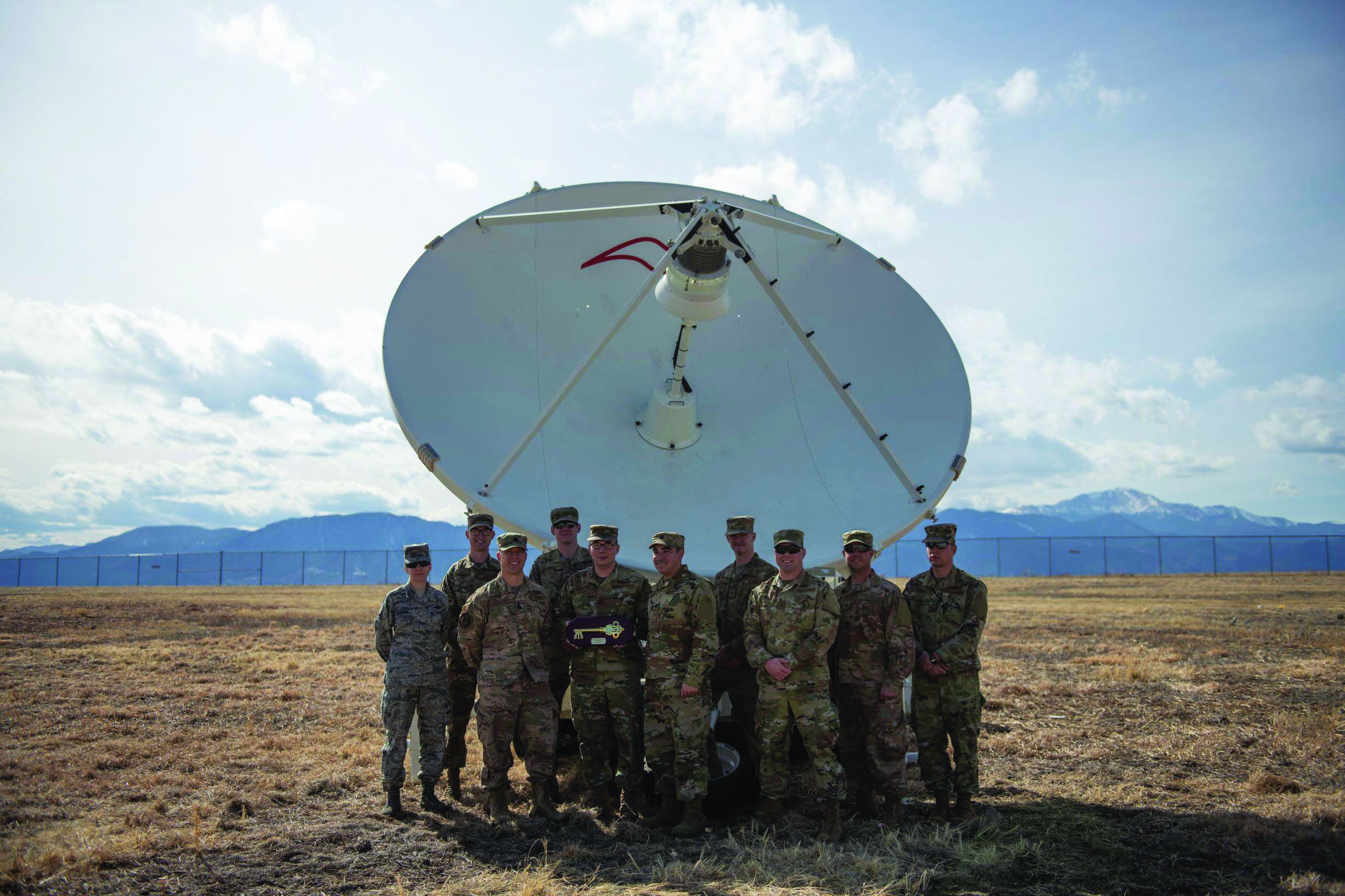
The Counter Communications System is a transportable space electronic warfare system that reversibly denies adversary satellite communications. It is the first space control platform acknowledged by the Space Force and provides quick reaction capability with direct operational support to the warfighter. First introduced in 2004, the CCS has undergone several upgrades, with Block 10.2 achieving Initial Operating Capability (IOC) in March 2020. Currently, the CCS is undergoing a “step-change” capability upgrade as it transitions to the “Meadowland” variant. On Dec. 11, 2025, L3Harris Technologies announced it had delivered the first Meadowlands Counter Communications System production unit to the U.S. Space Force’s Mission Delta 3. It is a compact ground-based satellite signal jammer.
Electronic Warfare · Next-Generation Jamming
Meadowlands
Electronic Warfare
Meadowlands is a ground-based satellite jamming system that provides advanced electronic warfare capabilities to disrupt enemy communications satellites. It is a major “step change” level upgrade to the Space Force’s first acknowledged offensive counterspace system, the Counter Communication System (CCS), which has been operational since 2004. The system is a mobile electronic warfare platform designed for interfering with enemy satellite communications through radio signal jamming. Meadowlands features expanded frequency range capabilities including multifrequency jamming in S-band and X-band, increased mobility with a significantly smaller footprint than its predecessor and incorporates remote command and control functionality to reduce the number of personnel required at the antenna site. The system uses radio signals to jam enemy communications, and the modernized version has an expanded frequency range, which improves its ability to interfere. The system is also lighter weight than its predecessor and has an open architecture that will allow for more regular software updates in the future. L3Harris won a contract in January 2019 for conversion of five CCS to Meadowlands standard. The Space Force formally accepted delivery of the first two developmental mobile Meadowlands satellite jammers from L3Harris in April 2025, with the delivery occurring approximately six months earlier than planned. A production contract signed in October 2021 runs through January 2028 for over 20 units and associated training systems. This will likely include upgrading its entire inventory of 11 CCS to the Meadowlands standard. The first production Meadowlands system was delivered in December 2025, and operations are expected to start in 2026.

Launch
National Security Space Launch vehicles supporting USSF mission requirements
Launch · Medium-Lift Partially Reusable
Falcon 9
Launch
Falcon 9 is SpaceX’s workhorse partially reusable two-stage orbital rocket that has revolutionized the launch industry with its reusability and high launch cadence. Since its debut in 2010, Falcon 9 has become the most frequently launched U.S. orbital rocket, dramatically lowering launch costs while maintaining high reliability. In 2020, it became the first commercial rocket to launch humans to orbit and continues to dominate the commercial launch market. Falcon 9 launched 165 times in 2025, more than every other launch vehicle combined. That included eight National Security Space Launch missions to low-, medium-, and geostationary transfer orbits.
Launch · Heavy-Lift Partially Reusable
Falcon Heavy
Launch
Falcon Heavy is currently one of the world’s most powerful operational rockets, composed of three Falcon 9 first stages working together as a heavy-lift launch vehicle. With 27 Merlin engines generating more than 5 million pounds of thrust at liftoff, Falcon Heavy can deliver large payloads to Earth orbit and beyond, including direct insertion into geosynchronous orbit and interplanetary trajectories. Falcon Heavy did not launch in 2025 but returned to flight in April 2026 with a commercial mission. It is scheduled for several more launches in 2026, but SpaceX is increasingly focused on developing Starship, a new rocket capable of delivering 150 percent of Falcon Heavy’s payload to LEO.
Launch · Heavy-Lift Expendable
Vulcan Centaur
Launch
Vulcan Centaur is ULA’s next-generation heavy-lift launch vehicle, designed to replace Atlas V and Delta IV rockets. Utilizing advanced technology from both legacy platforms along with innovations like Blue Origin’s BE-4 engines, Vulcan offers increased capabilities at competitive prices. Primarily developed to meet the requirements of the National Security Space Launch program, Vulcan completed its maiden flight in January 2024. Vulcan performed its second flight in October 2024 and suffered an anomaly with one of its solid rocket boosters, though the vehicle’s performance was not affected. After a lengthy certification process, the Space Force approved Vulcan for National Security Space Launch missions in March 2025, and it performed its first NSSL launch in August 2025.
Launch · Heavy-Lift Partially Reusable
New Glenn
Launch
New Glenn is Blue Origin’s orbital heavy-lift launch vehicle, representing the company’s entry into the orbital launch market. Named after astronaut John Glenn, this partially reusable rocket features a reusable first stage powered by seven BE-4 engines designed to land on an ocean platform and operate for a minimum of 25 flights. With its 7-meter diameter fairing and impressive payload capacity, New Glenn aims to serve commercial, civil, and national security missions. Blue Origin is planning a four-launch campaign to achieve certification for National Security Space Launch missions. New Glenn conducted its first launch in January 2025, followed by a second in November 2025 in which it successfully landed the rocket’s booster.
Audio of this article is brought to you by the Air & Space Forces Association, honoring and supporting our Airmen, Guardians, and their families. Find out more at afa.org