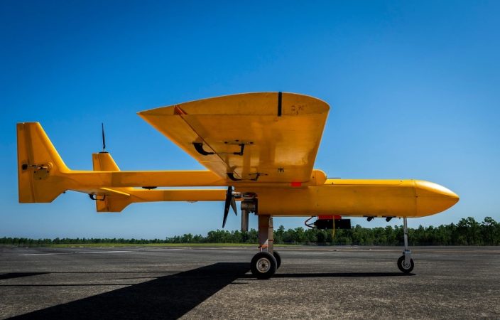
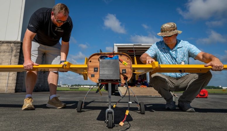
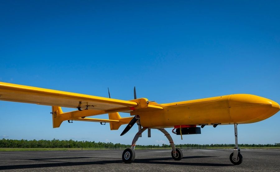
The Osprey MK III doesn’t look like much. The orange drone weighs 50 pounds, is just seven feet long, and its powerplant sounds more like a weed whacker than an aircraft engine, according to an eyewitness.
But the “bright orange dart,” as a recent press release described it, could help keep military aircrews from getting lost in future conflicts, where adversaries may try to jam or spoof the GPS signals that troops rely on for navigation.
GPS relies on a network of satellites orbiting more than 10,000 miles overhead. But officials worry that network can be disrupted by signal jamming, cyberattacks, or even kinetic anti-satellite weapons. That’s already happening in Eastern Europe, where Russian forces jam GPS and other satellite-based navigation systems in Ukraine and around the Baltic Sea, and in the Strait of Hormuz, where vessels wait to transit during the daytime due to GPS jamming.
The U.S. is launching new GPS satellites which transmit signals that are much more difficult to jam or spoof. But for another layer of protection, the military is also pursuing navigation systems that don’t rely on satellite signals.
In 2023, an Air Force C-17 tested a Magnetic Navigation (MagNav) system, a mini fridge-sized device that tracks variations in the Earth’s magnetic field caused by anomalies in the Earth’s crust, which form a magnetic map of the planet. The trick is sorting out the electromagnetic signal through the noise of lights, transmitters, computers and other devices found on most aircraft.
That’s where artificial intelligence comes in: a key part of MagNav is developing algorithms to sort through the noise. In 2024, a C-17 crew assigned to Joint Base Charleston, S.C. broke ground by using MagNav as the primary method of navigation in flight.
But MagNav is not the only solution. Another is called signals of opportunity: gleaning navigation data from radio, cellular, television, and other signals not intended for navigation. A third is visual navigation, using optical sensors and satellite imagery to closely track position, while a fourth is upgrading the inertial navigation system already found on most aircraft.
The goal would be for troops to have access to multiple systems for redunancy, Maj. Kyle McAlpin, a C-17 pilot involved with the MagNav project, told Air & Space Forces Magazine in 2023. But those systems must be tested, and sometimes a gas-guzzling beast such as the C-17 is overkill.

Enter the Osprey Mk III. The tiny drone made its first autonomous test flight at Eglin Air Force Base, Fla., in 2023 as part of the Autonomy, Data, and AI Experimentation Proving Ground, aimed at testing out autonomy and AI tools for real-world operations. Those tools include teaming up manned combat aircraft with unmanned drones, airdropping autonomous drones, installing apps directly onto aircraft while in-flight, and new navigation software.
The lightweight Osprey lets smaller businesses and startups test out these tools at a fraction of the cost of larger platforms.
“This type of Fly-Off provides small businesses the opportunity to vet their alternative navigation systems in a black-box test environment,” Lt. Col. Jonathan Gilbert, division chief of AFWERX Prime, which works with industry to develop new technologies, said in an Aug. 27 press release. “It enables an experimental approach that is replicable across systems, truly allowing us to measure each system’s performance.”
The press release did not specify what kind of internal navigation software the Osprey tested during an Aug. 15 flight, but it marked the first time the aircraft flew with a third-party developer’s software package. The release said a human directed the Osprey’s takeoff via a controller, but once airborne it became autonomous and relied on the alternative navigation software for location and flight guidance.
“The Autonomy Proving Ground is giving small businesses the opportunity to compete in acquisition without requiring them to fund any of their own testing,” Anthony Hix, who works with the 413th Flight Test Squadron and was lead for the test, said in the press release.


