DMSP is tasked with environmental data collection for worldwide, military weather forecasting. It provides timely and high-quality weather information to strategic and tactical combat units.
DMSP uses an operational line-scan sensor to image cloud cover in the visible and IR spectrum to analyze cloud patterns. It is equipped with microwave imagers and sounders and a suite of space environment sensors that provide critical land, sea, and space data.
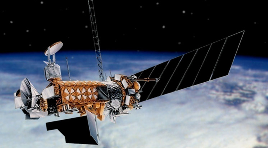
Block 5D-3 improved spacecraft bus and sensors for longer and more capable missions.
Six operational DMSP satellites now survey the entire Earth four times a day. DMSP-19 most recently launched in 2014. The vehicle subsequently suffered a power failure in early 2016, rendering it uncontrollable. Data from the craft remain usable until its orbit decays.
Congress canceled the DMSP program before the final spacecraft (DMSP-20) could be launched. USSF is replacing DMSP with a combination of the Weather System Follow-On-Microwave (WSF-M) which launched its first satellite in April 2024, and the future Electro-Optical/Infrared Weather System (EWS).
Defense Meteorological Support Program Technical Data
Contractors: Lockheed Martin, Northrop Grumman.
Operator/Location: National Oceanic and Atmospheric Administration; NOAA Operations Facility, Suitland, Md.
First Launch: May 23, 1962.
IOC: 1965.
Design Life: Five yrs (Block 5D-3).
Launch Vehicle: Delta IV; Atlas V.
Constellation: Four low Earth orbit (LEO).
Active Satellites: •Block 5D-3. Improved spacecraft bus and sensors for longer, more capable missions.
Dimensions: Length 25 ft (with array deployed), width 4 ft.
Weight: 2,545 lb, incl 772-lb sensor; 2,270 lb with 592-lb sensor payload.
Performance: Polar orbits; covers Earth in about 6 hr; primary sensor scans 1,800-mile-wide area.
Orbit Altitude: Approx 527 miles.
Power: Solar arrays generating 1,200-1,300 watts.