As the Space Force moves forward with plans to modernize its weather satellite architecture, it’s working closely with the National Oceanic and Atmospheric Administration to share data and leverage the agency’s modeling and validation tools, officials told lawmakers in a Jan. 13 hearing.
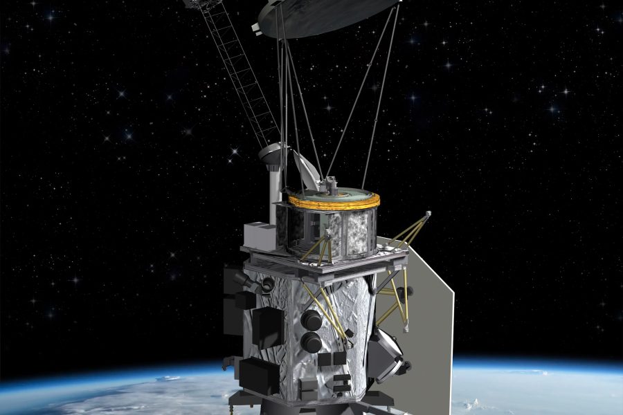
The Space Force is phasing out its Defense Meteorological Satellite Program and is in the midst of replacing that constellation with a mix of smaller satellites with disaggregated payloads. The near-term plan is to split DMSP sensors across two smaller programs: the Weather Satellite Follow-on Microwave, or WSF-M, and the Electro-Optical Weather System, EWS. WSF-M spacecraft are designed to identify and characterize tropical storms and high winds and measure snow and soil depth, whereas EWS satellites will carry electro-optical infrared sensors to provide imagery of cloud coverage and forecasts for military planners.
The Space Force launched its first WSF-M satellite, built by BAE Systems, in 2024 and plans to fly a second in 2028. The first General Atomics-built EWS satellite is slated launch later this year and the second in 2028.
During a hearing of the House Science, Space, and Technology Committee’s environment subcommittee, NOAA’s Deputy Assistant Administrator for Systems Irene Parker said the agency is working with the Pentagon to collect data from its initial WSF-M satellite, validate and calibrate that data, and turn it into “very valuable products” that can be used by the military for operational planning and by other federal agencies for emergency management and other missions.
In fact, Parker said, NOAA’s National Hurricane Center was able to leverage WSF-M data last summer during hurricane season to inform weather forecasts.
“We continue to plan to work with our DOD counterparts as they launch their second WSF-M satellite capability to ensure that the data is delivered on a timely and accurate basis,” Parker said. “We will continue to work with them to develop appropriate products that would then feed into our numerical weather prediction and forecasting capabilities to ensure that we’re improving our hurricane forecast and other capabilities.”
Interagency Collaboration
The Defense Department and NOAA have a long—and at times rocky—history of collaboration and interdependency. In the mid-1990s, the two agencies, along with NASA, set out to launch a joint program to replace DMSP and NOAA’s Polar Operational Environmental Satellite program with a single constellation, but the effort was canceled in 2010 due to cost overruns and delays.
Today, NOAA’s Geostationary Operational Environmental Satellites fill critical caps in the Pentagon’s global weather coverage and aid commander decision-making.
The agency’s Space Weather Prediction Center also helps the department model electromagnetic interference and communication disruptions, and its flood and fire danger assessments help installations prepare for hurricanes and winter weather.
Col. Bryan Mundhenk, Chief of the Air Force’s Weather Operations Division—which provides operational weather inputs for the Air Force, Space Force, Army, and intelligence community—testified during the hearing that the military’s partnership with NOAA not only helps the government avoid duplication and inefficiency, but it’s critical to U.S. and allied national security.
“Our ability to sense and make sense of the current and future states of the operating environment relies on data received from and through NOAA,” Mundhenk said. “Over the decades, these organizations have evolved into key components of an interagency meteorological enterprise that is a national asset for mitigating risk and ensuring national security.”
NOAA is in the midst of modernizing its own weather satellite architecture, including the GOESS constellation. In July, the Trump administration proposed a $1.5 billion cut to the agency’s budget, which would reduce the scope of the GOESS follow-on effort. However, Congress is in the late stages of approving a fiscal 2026 appropriations bill that would protect NOAA and the GOESS modernization program from the bulk of those cuts; the House approved a compromise bill Jan. 8 and the Senate is expected to vote in the coming days.
DOD plans to leverage the GOESS follow-on satellites, dubbed the Geostationary Extended Observations program, or GeoXO. Asked during the hearing whether the department is concerned its weather capabilities would be impacted by future cuts to the program, Mundhenk said he’s confident the service’s needs are “being heard” and that communication between the agencies is strong.
Future Weather Architecture
Amid the Space Force’s deployment of WSF-M and EWS satellites, the service is also crafting a longer- term plan to expand and fill gaps in its weather satellite architecture. As part of that plan, it’s considering how it might use commercial spacecraft and data to complement the dedicated military satellites that will make up its future constellation.
In October, the service announced it awarded Muon Space a $44 million contract to modify its existing multispectral imaging payload, Quickbeam, to a new military variant called Quickbeam-S. The sensor will use a scanning imager that spans nine spectral channels to support a range of military missions. Under the contract, Muon will deliver three satellites with the new payload that the Space Force will use for on-orbit demonstrations and to inform its strategy for commercial weather data.
“This prototype effort is part of a broader commercial environmental monitoring Data as a Service strategy to demonstrate how commercial weather data could be integrated into existing Government systems to deliver capabilities faster and more efficiently through commercial solutions,” a spokesperson for Space System Command told Air & Space Forces Magazine in October.
The Space Force is also surveying industry to gauge what additional data and services is commercially available. Space Systems Command issued a notice to industry Jan. 5, stating its interest in a range of ground- and space-based remote sensing technology across multiple orbits, including low-cost payloads and sensors, atmospheric instrumentation, and advanced data processing capabilities.
“The objective is to enhance the resilience, responsiveness, and accuracy of environmental data products supporting operations, planning, and decision-making,” SSC said in the notice.