Defense Meteorological Support Program is tasked with environmental data collection for worldwide, military weather forecasting. It provides timely and high-quality weather information to strategic and tactical combat units worldwide.
DMSP uses an operational line scan sensor to image cloud cover in visible and thermal IR and analyze cloud patterns. It is equipped with microwave imagers and sounders and a suite of space environment sensors that provide critical land, sea, and space environment data.
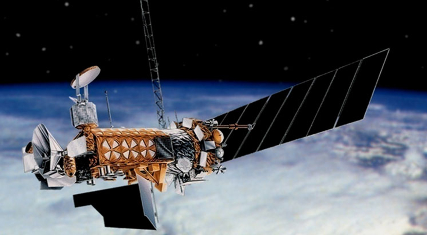
Block 5D-3 improved spacecraft bus and sensors for longer and more capable missions.
Six operational DMSP satellites now survey the entire Earth four times a day. The oldest operational satellite, DMSP-13, suffered an apparent electrical short and exploded, creating a cloud of debris in space in 2015.
DMSP-19 most recently launched in 2014. The vehicle subsequently suffered a power failure in early 2016, rendering it uncontrollable. Data from the craft remains usable until its orbit decays.
Congress canceled the DMSP program before the final spacecraft (DMSP-20) could be launched. DMSP-20 was stored, awaiting a launch decision to replace DMSP-19. DMSP-17 ultimately assumed the failed satellite’s coverage, and DMSP-20 went on permanent display at Los Angeles AFB, Calif.
USAF is considering requirements for a follow-on system. The service awarded Ball Aerospace a $255.4 million development contract for the Weather System Follow-On-Microwave (WSF-M) in November 2018, and the system is planned to replace DMSP starting in FY24.
DMSP-14, the last operational Block 5D-2 satellite, was decommissioned Feb. 11, 2020, after 22 years of service.
Contractors: Lockheed Martin, Northrop Grumman.
Operator/Location: National Oceanic and Atmospheric Administration; NOAA Operations Facility, Suitland, Md.
First Launch: May 23, 1962.
IOC: 1965.
Design Life: Five yrs (Block 5D-3).
Launch Vehicle: Delta IV; Atlas V.
Constellation: Four low Earth orbit (LEO).
Active Satellites: •Block 5D-3. Improved spacecraft bus and sensors for longer, more capable missions.
Dimensions: Length 25 ft (with array deployed), width 4 ft.
Weight: 2,545 lb, incl 772-lb sensor; 2,270 lb with 592-lb sensor payload.
Performance: Polar orbits; covers Earth in about 6 hr; primary sensor scans 1,800-mile-wide area.
Orbit Altitude: Approx 527 miles.
Power: Solar arrays generating 1,200-1,300 watts.