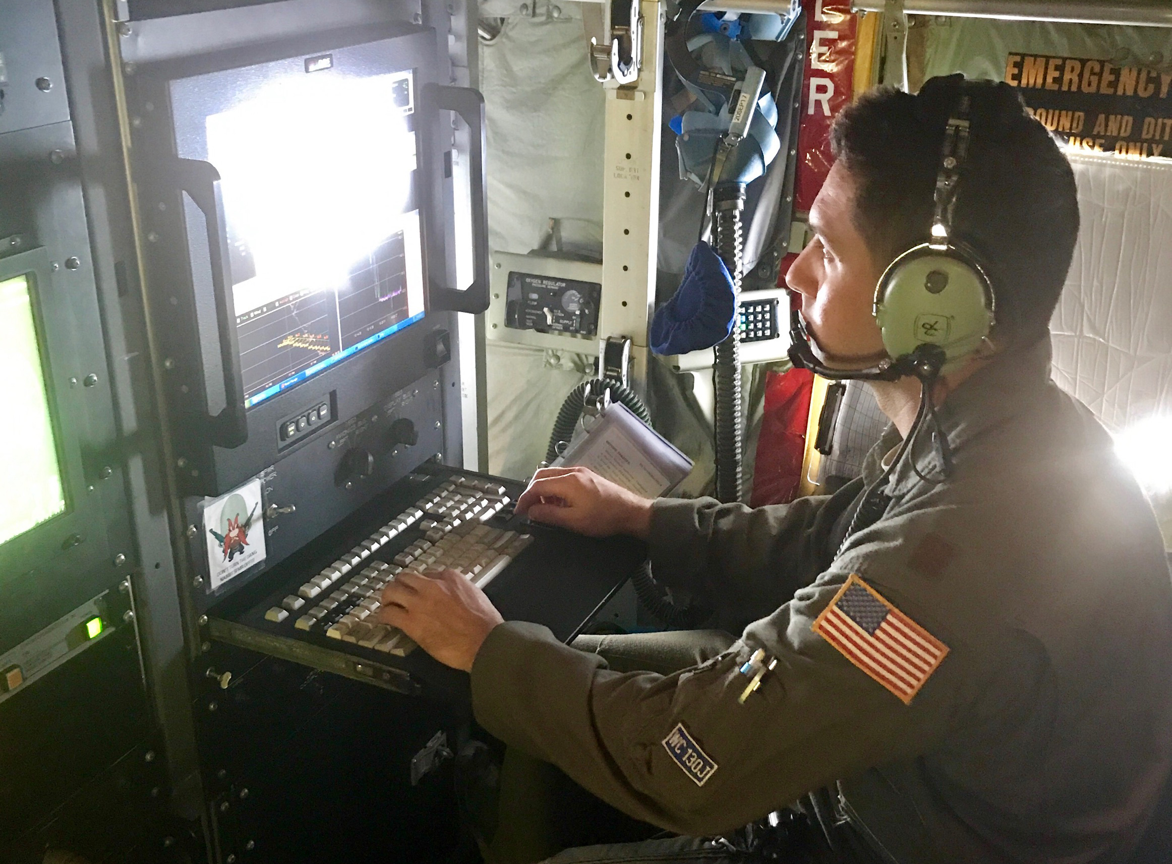
Maj. Jeremy DeHart, with the 53rd Weather Reconnaissance Squadron, otherwise known as the Hurricane Hunters, compiles storm data at an unspecified time and location. USAF photo by Maj. Kendall Dunn.
Maj. Jeremy DeHart and a handful of airmen assigned to the Air Force Reserve’s 53rd Weather Reconnaissance Squadron had less than 10 minutes to get what they needed from the eye of Hurricane Irma before they would punch back into the storm through its wall.
He, and the rest of the Hurricane Hunters, arrived in St. Croix on Sept. 3, ahead of Irma’s approach. Every three hours, a WC-130J flies into the storm, transmitting vital information to the National Oceanic and Atmospheric Administration’s National Hurricane Center.
DeHart, whose job is to be on the prowl for severe weather, told Air Force Magazine the Hunters are already looking past Irma, concurrently flying missions into Hurricane Katia, which formed in the Gulf of Mexico Thursday, and Hurricane Jose, a Category 4 storm tailing Irma.
This many storms “stretches everybody thin,” he said. “We’ve been able to fly all these storms with really no break,” but he said if and when more storms continue to appear, it may become an issue of “prioritization.”
Despite being spread thin, the Hunters work around the clock to help everyone from the public to government entities make vital decisions about potentially deadly storms.
The Hurricane Hunters enter the storm from one quadrant—for example, its northeastern corner—and exit through the opposite quadrant—in this example, its southwestern corner.
In the middle of this trek across the storm, right in its eye, the airmen manning the WC-130J gather information about the storm and transmit it in real time to NOAA in what’s called a vortex data message, or a VDM, which fixes the storm center’s particulars.
They don’t have too much time to do so. On Sept. 6, for example, as DeHart flew into Irma’s eye, which stretched about 25 miles, the crew had “seven or eight minutes” to do its job, DeHart said. Making things worse, those minutes are sandwiched between what DeHart called the “roughest” parts of the flight, when the crew “punches” through the storm wall into and out of its eye.
DeHart compared the turbulent experience to riding a roller coaster, and though he admitted he’s still a bit uneasy heading into the storms, it’s been just under 43 years since the last Hurricane Hunter crashed into the South China Sea. The aircraft debris and the bodies of the six airmen aboard were never recovered.
“Some of the most common questions we get are ‘Are we nervous? Are we anxious?’ And the answer is ‘yes,’” DeHart said.
Sensors on the aircraft gather information including wind level, pressure, bearing, and other points NOAA uses to predict the course, severity, and potential impact of the storm. For example, a device called a stepped frequency microwave radiometer, mounted on the wing, calculates the microwave radiation emitted by the ocean’s surface. The SFMR then uses this information to approximate the winds at the surface. Another notable device is the dropsonde, a tube-like suite of sensors simply dropped from the belly of the aircraft into the storm. A parachute stabilizes the 16-inch-long dropsonde’s descent as it transmits atmospheric data upwards into the aircraft, allowing for hard observations about the surface of the storm.
Such calculations are no small feat considering the crew’s flying at about 10,000 feet for a hurricane the size of Irma. That altitude is determined for both the crew’s safety and because at that distance from the ground, during a storm like Irma, some conditions are similar to those at surface level. Smaller storms allow for lower flight altitudes, even as low as a thousand feet for would-be storms the Hunters might be tracking. An initial vortex data message goes out to NOAA as soon as the sensors have completed gathering raw information. Then, a weather reconnaissance officer—like DeHart—sifts through the numbers and checks them, engaging in quality control and looking for potential errors or red flags. This takes about “10 to 15 minutes,” Dehart said, at the end of which a second VDM goes out to NOAA.
“That’s the biggest benefit of live reconnaissance data,” DeHart said. “We’ve come a long way with our technology, but nothing substitutes” the information the crew can provide.
After finishing one trek across the storm, the Hunters enter the storm again through the remaining two quadrants, and transmit another set of VDMs to NOAA. Each pair of “fixes” is called an “alpha pattern,” which is what the Hunters do every three hours.
NOAA uses the Hunters’ VDMs to disseminate actionable advice—with particular focus on the predicted condition of the storm’s surface level—to the general public and to local government as they brace for impact.
For each mile of coastline in a forced evacuation, authorities can expect to spend about $1 million. Reducing the “cone of uncertainty” surrounding the journey of a major storm, which is what the Hurricane Hunters help NOAA do, informs better decisions, DeHart said.
Just over a year into the job, DeHart said he’s looking forward to accomplishing his mission for years to come.
“For weather officers” he said, “this is the coolest job in the world.”