The time is now to rebuild our northern tier defenses.
Modern adversaries like Russia and China spent the past three decades developing and fielding advanced weapons capable of striking the U.S. homeland. Today, their advanced nuclear and nonnuclear missiles have the range and capability to hold vital American centers of gravity at risk from thousands of miles away, making U.S. military and civilian targets more vulnerable to aerial attack than ever before.
The advent of operational hypersonic missiles is especially concerning, potentially enabling Russian aircraft to strike New York or Washington, D.C., in less than 60 minutes from launch to delivery. Advanced cruise missiles able to transit thousands of miles, fly unpredictable flight paths under existing radar coverage, and cause potentially disastrous effects are now available in high volume and at low cost, posing another significant effect. The current decimation of major Ukrainian targets offers a warning about what the U.S. could face in a future conflict.
Brig. Gen. Houston Cantwell, USAF (Ret.), is a Senior Resident Fellow for Aerospace Studies at AFA’s Mitchell Institute for Aerospace Studies.
Download the entire report athttp://MitchellAerospacePower.org
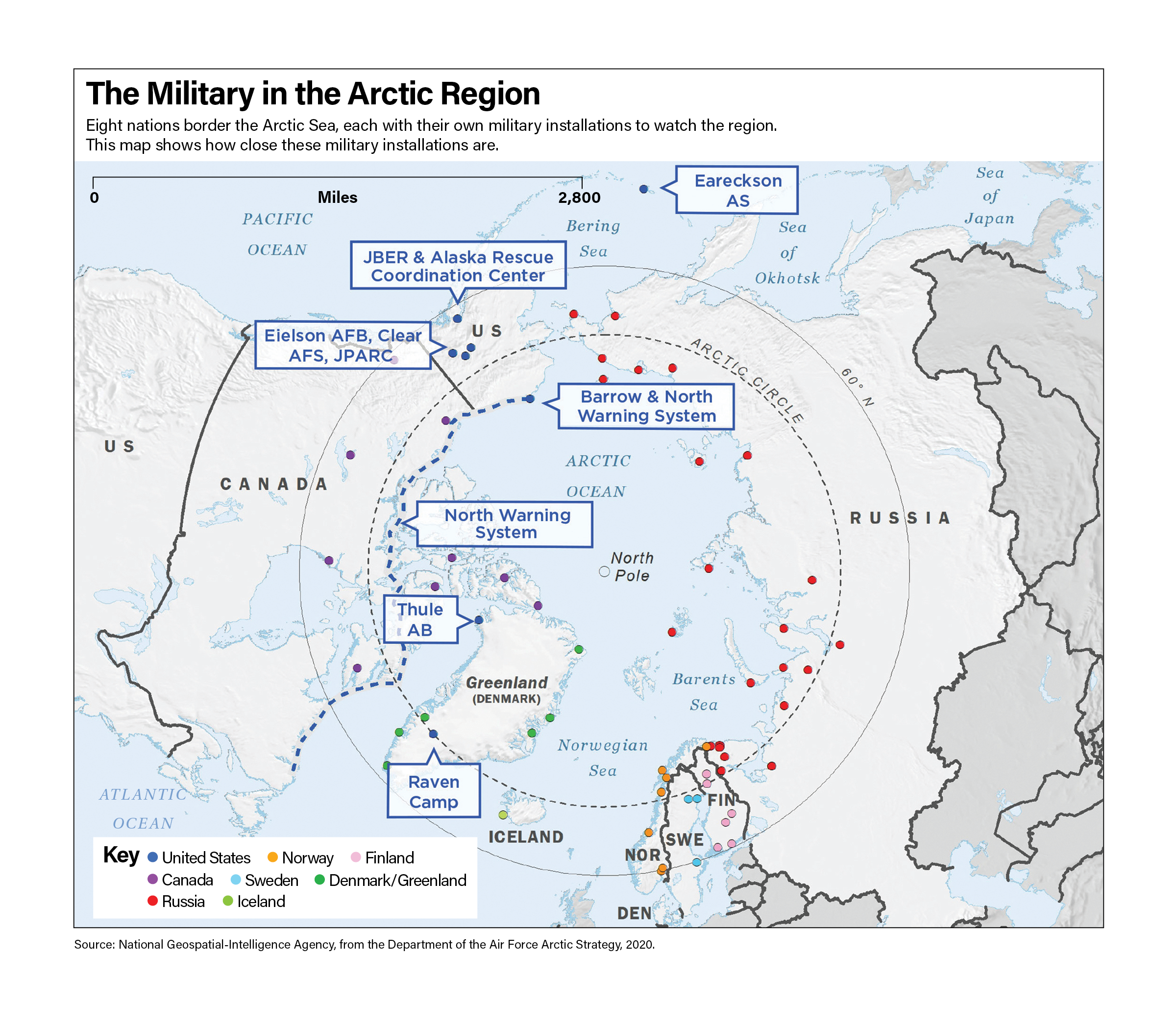
Nowhere is America’s exposure to attack more acute than from its Arctic approaches—the most direct corridor through which both Russia and China could strike the United States. Alaska, America’s Arctic outpost, has long been seen as a key strategic site. “I believe that in the future, whoever holds Alaska will hold the world,” airpower pioneer Gen. Billy Mitchell told Congress in 1935. “I think it is the most important strategic place in the world.” Ninety years later, at his confirmation hearing in October, incoming Air Force Chief of Staff Gen. Kenneth Wilsbach was asked if he agreed. “I do believe,” he said, “that it is the most strategic spot on Earth.” The Cold War saw the United States develop and operate extensive early warning systems to ensure the military could detect Soviet bomber aircraft far across the Arctic region. Those systems aged out, however, and are no longer operable. More important, today’s threats are more varied, harder to detect, and less predictable than the weapons of the Cold War era. Today’s Arctic domain awareness (ADA) capabilities and capacity are woefully insufficient to the threat.
A modern, effective enterprise must detect, track, and analyze military movements and other activities in real-time using a variety of air, surface, and space sensors to collect and share information from multiple azimuths. It is time for the United States to rebuild its northern tier defenses.
At a macro level, addressing America’s Arctic vulnerabilities means improving the overall sensor network, enhancing information sharing between organizations, and promoting Arctic nation collaboration. A successful upgraded enterprise must deter Arctic threats, ensure early warning of advanced airborne threats, give decision-makers sufficient time to react and respond, and set the conditions to defeat adversaries if required.
The North American Air Defense Command (NORAD) was established in 1958, creating a combined U.S.-Canada capability to jointly defend the continent. The command’s sensors were capable of detecting Soviet bombers armed with gravity bombs if they dared fly attack routes across Canadian and U.S. airspace. It developed a command and control network that shared information fast enough to respond to the inbound aircraft. A close binational relationship, a robust radar network, and the ability to share information at a speed relevant to military decision makers formed the basis of this successful North American air defense partnership. “For decades, NORAD has relied heavily on the North Warning System (NWS) arrayed along the Arctic coasts of Canada and Alaska to detect potential airborne threats to North America,” said Gen. Glen VanHerck, then-commander of NORAD and U.S. Northern Command in March 2023. “It is clear that our competitors possess long-range strike capabilities that could be used to attack the United States and Canada from outside the detection range of legacy sensors.” Much of NORAD’s sensor- and information-sharing networks are no longer relevant to 21st-century threats. Russia and China spent the past three decades developing and fielding advanced weapons capable of striking the U.S. homeland from afar. Now, the Trump administration is signaling an increased focus on such threats, including with its Golden Dome initiative and its renewed strategic interest in Greenland. But any plan to bolster homeland defense must begin with enhancing Arctic security. This initiative must restore Arctic domain awareness by updating NORAD’s early-warning sensors, breaking down information stovepipes that slow information flow, and enhancing relationships with NATO Arctic nations.
The Russia, China Arctic Threat
Russia and China’s motivations for increased Arctic presence tie to three main desires: to hold the continental United States at risk for reasons of peer competition; to ensure access to Arctic natural resources; and to ensure access to time-saving maritime Arctic trade routes. Russia’s Arctic military activities are particularly aggressive. In 2022, Russian naval doctrine raised the Arctic region to its highest priority, and President Vladimir Putin directed the construction of more than 475 military facilities across the region. Hudson Institute’s Liselotte Odgaard observes these Russian installations are protected by a multilayered network of sensors and defense systems to ensure they can generate military effects on U.S. mainland targets. Roughly two-thirds of the Russian Navy’s nuclear strike capabilities are harbored in the Barents Sea, allowing a direct and mostly undetectable path to North America and Europe.
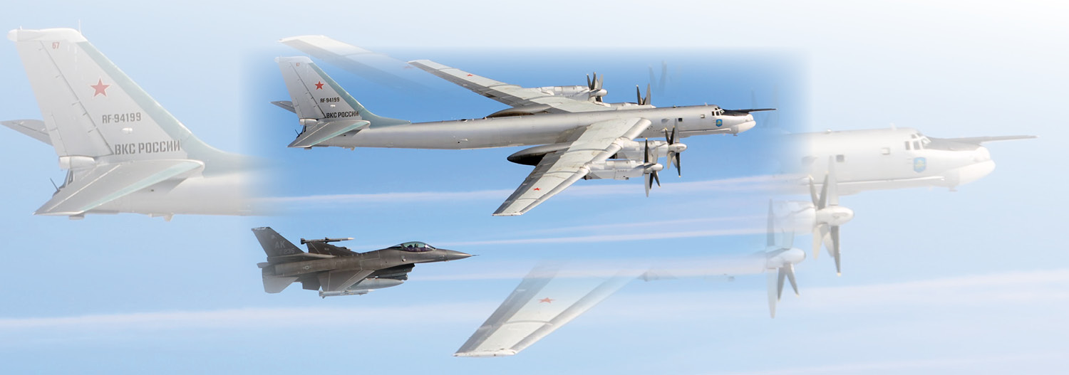
China’s foray into Arctic activities cover a spectrum of both civil and military activities including scientific research, trade agreements, public diplomacy, infrastructure investments, and increased military presence. In July 2024, their military activities caught worldwide attention due to their close coordination with Russian forces in the region. A joint bomber task force comprising two Russian Tu-95 strategic bombers and two Chinese H-6 strategic bombers penetrated the Alaskan Air Defense Identification Zone (ADIZ). This was the first time China and Russia conducted a joint air patrol near Alaska and the first time the two countries launched aircraft from the same Russian airfield. The task force was also unique in that it demonstrated a close relationship between the two air forces that had not been demonstrated before. China’s Arctic maritime activities are not all civil, either. In 2024, the PRC expanded its maritime military force projection capabilities. Chinese surface combatants deployed to the Bering Sea for the fourth straight year and operated within cruise missile range of critical infrastructure throughout Alaska.
Arctic Domain Awareness Hurdles
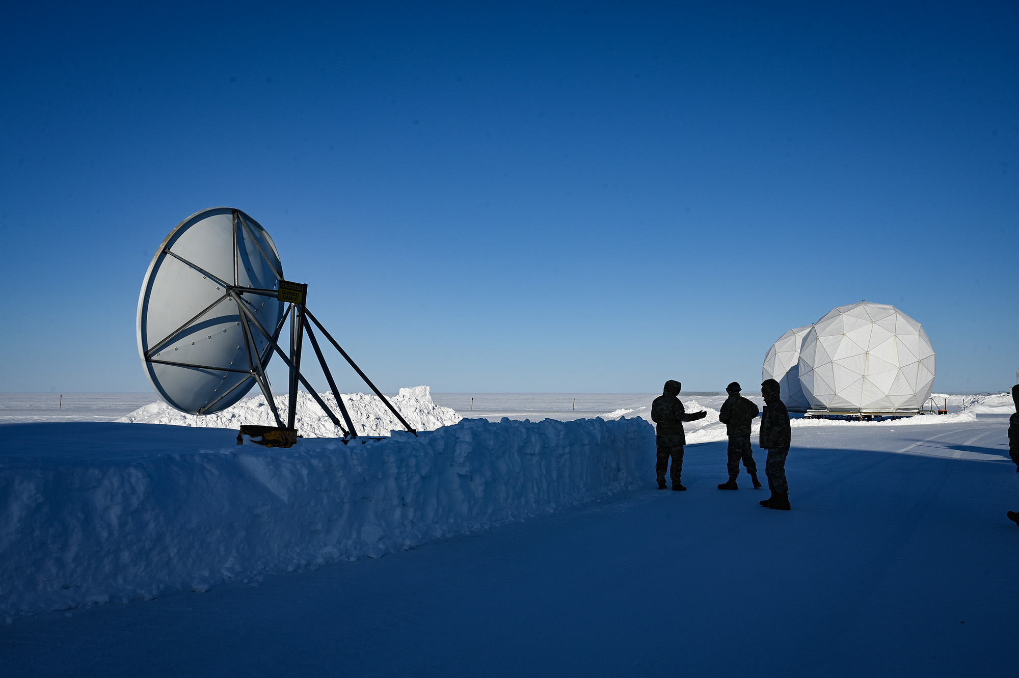
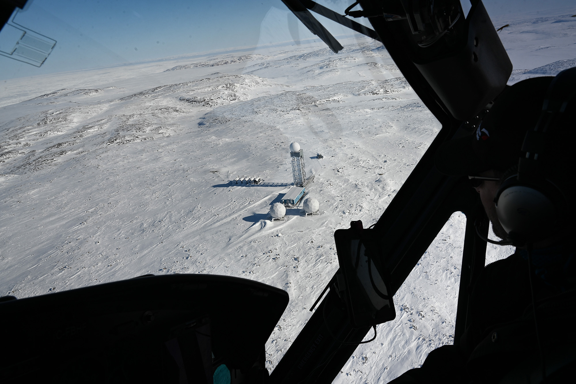
As the threats continue to mount from and through the Arctic, the U.S. capability to detect modern threats wanes. Constructed in the late 1980s, the NWS comprises 47 radar sites across northern Canada and provides an important radar feed into NORAD situational awareness. Designed to detect high-flying nonstealth aircraft, the line of radars can detect aircraft over 100 miles away at altitudes up to 100,000 feet. But, low-flying, stealth, long-range missiles and drones have the ability to evade the system. The radar’s lack of range allows strike aircraft the opportunity to remain out of radar coverage while launching their missiles. Aside from air-launched cruise missiles, NWS radars also lack the ability to detect and track advanced hypersonic missiles. Ideally, an NWS replacement would detect modern threats including cruise missiles, hypersonic missiles, and small drones.
Information sharing also remains a considerable hurdle. Multiple command and control seams merge within the Arctic. These seams include three U.S. Combatant Commands and two multi-national commands—NORAD and NATO’s Joint Force Command (JFC) Norfolk. This unusually high number of command fault lines makes information sharing between the multiple organizations exceptionally challenging. Former NORAD Commander Gen. Glen VanHerck stated, “[The Chinese balloon incident] is a failure of multiple intelligence, and [Department of Defense] agencies. I should not get surprised by something that’s coming into my area of responsibility. … Anybody who knows about it should pass that on. It shouldn’t be less than 24 hours’ notice.” Information exchange seams within the Department of Defense delayed the handoff of this slow-moving threat.
The challenges to information sharing extend beyond U.S. borders. International coalition and partner nation information sharing requirements add additional layers of complexity. From a technical perspective, respective countries typically operate on separate and distinct computer networks. Politically, countries wrestle with releasability policies governing the sharing of classified information across these computer networks. NATO and NORAD do not share a common operating picture, they operate at different classification levels, and they retain very few means of secure communications between the two organizations. As activity in the Arctic increases, these gaps must be addressed to permit the timely sharing of classified threats.
Future threats traveling at greater speeds only compound the challenge. Tracking the activities of multiple adversary weapon systems across the vast Arctic expanse requires a complex information and intelligence network that necessarily works across governmental and international borders and involves dozens of separate organizations. As changes occur in the environment and threats emerge, relevant information must be properly analyzed and then provided to decision-makers throughout the NORAD chain of command in order to take appropriate action.
Moving Forward with Purpose
A review of the Arctic security situation reveals a concerning vulnerability to homeland defense. Inadequate domain awareness leaves the United States open to strategic attack. China and Russia’s continued proliferation of precise long-range conventional aerial weapons, their desire to hold our strategic interests at risk, and their increasing Arctic activities make the situation dire. Reducing this threat will require a combination of efforts centering on improved domain sensing, improved information exchange, and international partnerships.
The scale and scope of this modern threat environment demands that a northern tier defense begin with a layered sensor network feeding command centers and decision-makers. Turning robust domain awareness into necessary and appropriate responses to various threats relies on a set of cascading steps. First, sensors need to scan to detect objects at range. From there, tracks must be established to determine the vector, potentially intimating the intent, of the asset in question. For example, an airborne asset flying along a border is different than one crossing a border and flying toward a populated area. If the asset in question appears to have hostile intent, it is deemed a threat and must be targeted for interception, which may include a kinetic kill. There is no single system that executes these functions. Instead, it takes a variety of technologies on the surface, in the air, and in space to engage collaboratively. Each domain capability has respective advantages and weaknesses, but the goal is to field a combined set of surface-, air-, and space-based sensors that eliminates gaps in data or information and provides timely domain awareness and command and control.
Over-the-horizon radars (OTHRs) provide a formidable capability for detection and tracking. The sensors outperform traditional radars by providing much greater detection ranges and covering larger volumes of airspace. Existing OTHR systems can detect targets at distances between 600 and 1,800 nautical miles, and because they lack the necessary fidelity for targeting, are best suited to threat detection and tracking. Both Canada and the United States are working on OTHR: Canada committed $6.9 billion to modernize their surveillance systems and highlighted the importance of OTHR and satellites in their 2022 national defense strategy, “Our North, Strong and Free: A Renewed Vision for Canada’s Defence.” They plan to deploy two separate arrays—the Arctic OTHR, located along the U.S.-Canada border, and the Polar OTHR, located near the Arctic Circle. Once in place they will provide an unprecedented improvement over the existing North Warning System, their radar search areas extending out thousands of miles for critical early threat detection.
Space-based radar could supplement these OTHR capabilities, adding another layer of threat detection and tracking. But that technology may still be years away from operational relevance. Space-based Airborne Moving Target Indicator (AMTI) technology has great promise in this area, and recent advancements in small satellites and the exponential growth of proliferated low-Earth orbit (LEO) satellite constellations could potentially bring this capability within reach. But technological hurdles remain, and betting the future on those capabilities maturing in the near term poses significant risk.
Because surface and space-based radar data is not yet targeting-quality, an airborne layer affords additional options that could provide the fidelity needed to establish tracks and generate targeting data. Unlike OTHR and space-based AMTI, these systems are available now. The E-3 AWACS and its successor, the E-7 Wedgetail, both carry early-warning radars capable of detecting targets hundreds of miles away. Though these airborne radars lack the range of surface or space-based systems, they can fill gaps in degraded data, bring flexibility in sensing options, and have the ability cover expected avenues of attack.
Uninhabited aircraft could be used to complement manned aircraft in the airborne early-warning mission. Aircraft such as the MQ-9 and RQ-4 can fly higher and longer and, if equipped with appropriate sensors, could perform the mission at a lower operating cost with fewer crew members. That means several aircraft could operate at once for roughly the same cost as a single E-3 or E-7 aircraft. Importantly, however, this does not negate the need for E-3s and E-7s. Airborne early-warning aircraft provide irreplaceable airborne battle management capabilities. Uninhabited aircraft extend the range and complexity of the airborne early-warning sensing grid while enhancing the inhabited aircraft’s ability to perform critical battle management roles.
Information Dominance
“While the future of homeland defense may look vastly different than the current architecture, it will continue to depend on the pillars USNORTHCOM and NORAD use today—all-domain awareness; information dominance; decision superiority; and global integration,” said Gen. Gregory Guillot, commander of USNORTHCOM and NORAD in testimony to Congress in March 2024.
If information dominance is a pillar of homeland defense, a streamlined information flow is also a critical requirement. Tracking multiple adversary weapon systems across the vast Arctic expanse requires a complex information and intelligence network spanning international borders and involving dozens of government organizations. As changes occur and threats emerge, the data must be analyzed and delivered to appropriate decision-makers throughout the NORAD chain of command.
“DOD will explore options to expand collaboration with Federal interagency partners and improve information sharing with Arctic allies and partners,” states the Pentagon’s Arctic strategy. Guillot likewise has testified: “Addressing threats from long-range missiles, cyberattacks, and uninhabited aerial systems requires close coordination and collaboration with a host of interagency, international, and DOD partners, and USNORTHCOM and NORAD are ideally situated to serve as the synchronizer and integrator for that crucial whole-of-government enterprise.”
Challenging that are a variety of impediments that retard the flow of information, reducing the region’s overall security posture. Both policy and technical challenges must be identified and removed.
Information-sharing agreements between the Federal Aviation Administration (FAA) and NORAD should be extended across the Atlantic to NATO and Eurocontrol. The Chief Digital and Artificial Intelligence Office’s (CDAO) Global Information Dominance Experiments (GIDE) must be empowered to further break down information barriers between military and governmental offices. Hosting military exercises between NORAD and NATO would promote the ability to share classified information in a timely manner. Finally, adopting software like DOD’s Maven Smart System can speed the flow of information across the chain of command, providing decision-makers more time to respond to dynamic situations while accessing greater levels of information.
CONCLUSION
Improved domain sensing rests on a layered set of systems comprising surface, air, and space capabilities. None of the systems are independently sufficient for the epic task of providing Arctic domain awareness, so each component is complementary to the others. The cornerstone of domain awareness is the surface-based OTHR replacement for NWS. Of all the recommended components, this system brings the most capability in the shortest time frame. Airborne components bring the greatest flexibility and survivability. The uninhabited MQ-9 and RQ-4 aircraft are ideally suited for the surveillance mission, given their high operating altitudes and long endurance. The E-7 has the greatest air-to-air radar capabilities and serves as an independent command and control node. Finally, the space-based component to domain awareness, while not yet technologically mature, has great potential. With sufficient investment, it can eventually replace the need for complex ground-based OTHR systems.
Equally important to a layered sensing architecture is an efficient information-sharing enterprise encompassing DOD, state, other federal institutions, and pertinent allied entities. A holistic intelligence and information sharing network must break down technical and policy barriers to increase cooperation and speed. DOD’s CDAO office plays an important role in reducing the information stovepipes within the department, but it will take action above the DOD level to ensure information flow between governmental departments and partner nations. The Department of Transportation, Homeland Security, and Eurocontrol are all prime examples of organizations that routinely handle information pertinent to Arctic domain awareness and require seamless ties to NORAD’s common operational picture.
Finally, European nations ideally located on Russia’s Arctic front door offer important partnership opportunities. European countries on the Scandinavian Peninsula offer significant insights into Russian military activity with their front-row view of the adversary, in addition to their deep cultural understanding. These countries routinely collect critical information on Russia that should directly feed NORAD’s intelligence assessment and common operational picture. Despite recognition of this partnership’s importance, few touchpoints presently exist between NORAD and the Joint Nordic Air Command. Deliberate DOD efforts could alleviate this shortfall.
The United States cannot allow the increasing Russian and Chinese Arctic threat to go unchecked. An improved early-warning sensor network combined with enhanced information sharing and Arctic nation collaboration would set the foundation for improved North American security.