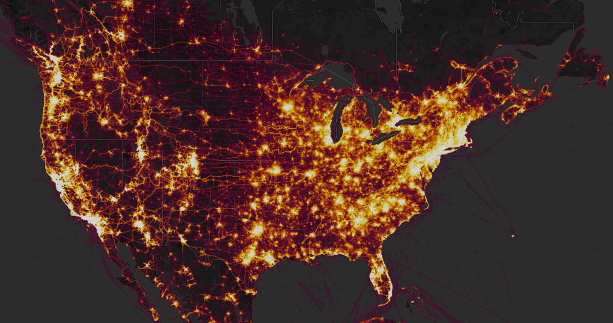
The fitness tracking network Strava posted a "heatmap," shown here, that showed running routes at remote US military facilities, including some not publicized by the Pentagon, where service members use various apps and tracking tools, such as FitBit, to track their exercise progress. Screenshot of Strava heatmap.
The Pentagon is launching a review and urging all its personnel to place strict privacy settings on social media applications after a fitness-tracking site published a map that hinted at the locations of clandestine military bases.
The fitness tracking network Strava posts a “Heatmap” of its usage, tracking where its users run and bicycle through the use of smartphones, fitness tracking devices such as FitBits, and other GPS-enabled watches. This map included running routes at remote US military facilities, where service members exercise and use the application to keep track of their progress. This includes special operations bases and airstrips in Syria, across Iraq, and in Afghanistan.
The Pentagon on Monday said it is launching a review of its procedures regarding social media usage. Service members, who receive yearly training on social media use, are urged to select the strictest security settings to avoid publicly disclosing their locations, Pentagon spokesman US Army Col. Rob Manning said Monday.
The Defense Department hasn’t directly spoken with Strava regarding the map, Manning said. The company, in a statement to CNN, said it is “committed to helping people understand” privacy settings.
Manning said the military isn’t yet considering a full ban on fitness-tracking devices, but said it has “full confidence” in commanders’ abilities to enforce operational security measures.
Strava’s map anonymously aggregates routes ran or cycled by its users as a way to show fitness activity globally and give runners and cyclists ideas of possible routes.
Inside Afghanistan, for example, the map shows heavy usage at large, known locations such as Bagram Airfield and Hamid Karzai International Airport. It also shows small, austere locations where military members run inside compounds for fitness. In some locations, it also shows patrol routes where service members have left their applications on while patrolling. In Syria, the map confirms fitness activity at locations the Pentagon has not publicly disclosed.
The application’s popularity, and the public nature of the map, shows the ongoing need for the Defense Department to regularly review its procedures relating to military member’s lives online, Manning said.